Featured
Cooper Spur Mountain Resort & Ski Area
Family-friendly Cooper SpurMountain Resort specializes in presenting affordable winter fun…
Mt. Hood Meadows
Mt. Hood Meadows Ski Resort operates on a special use…
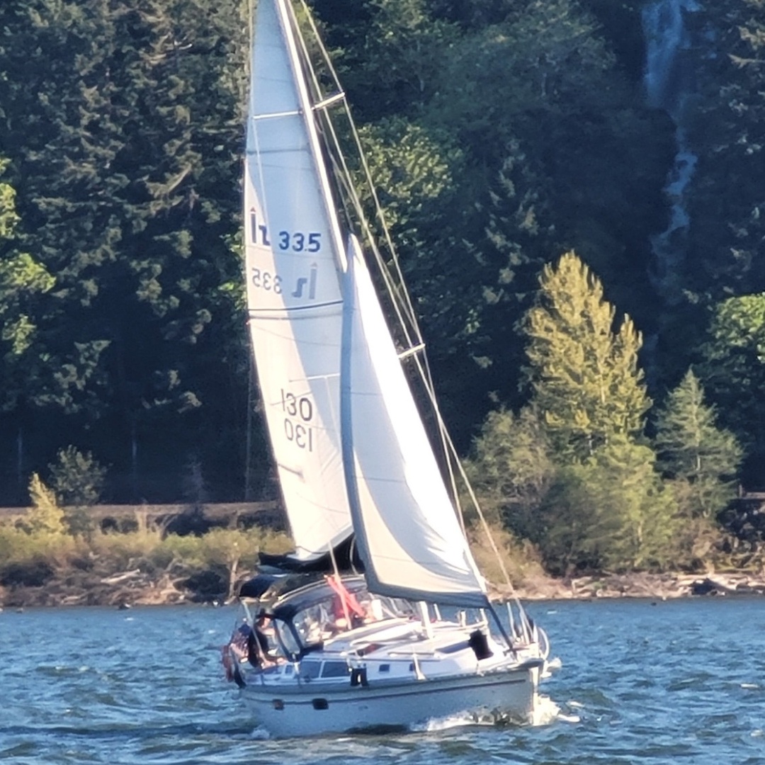
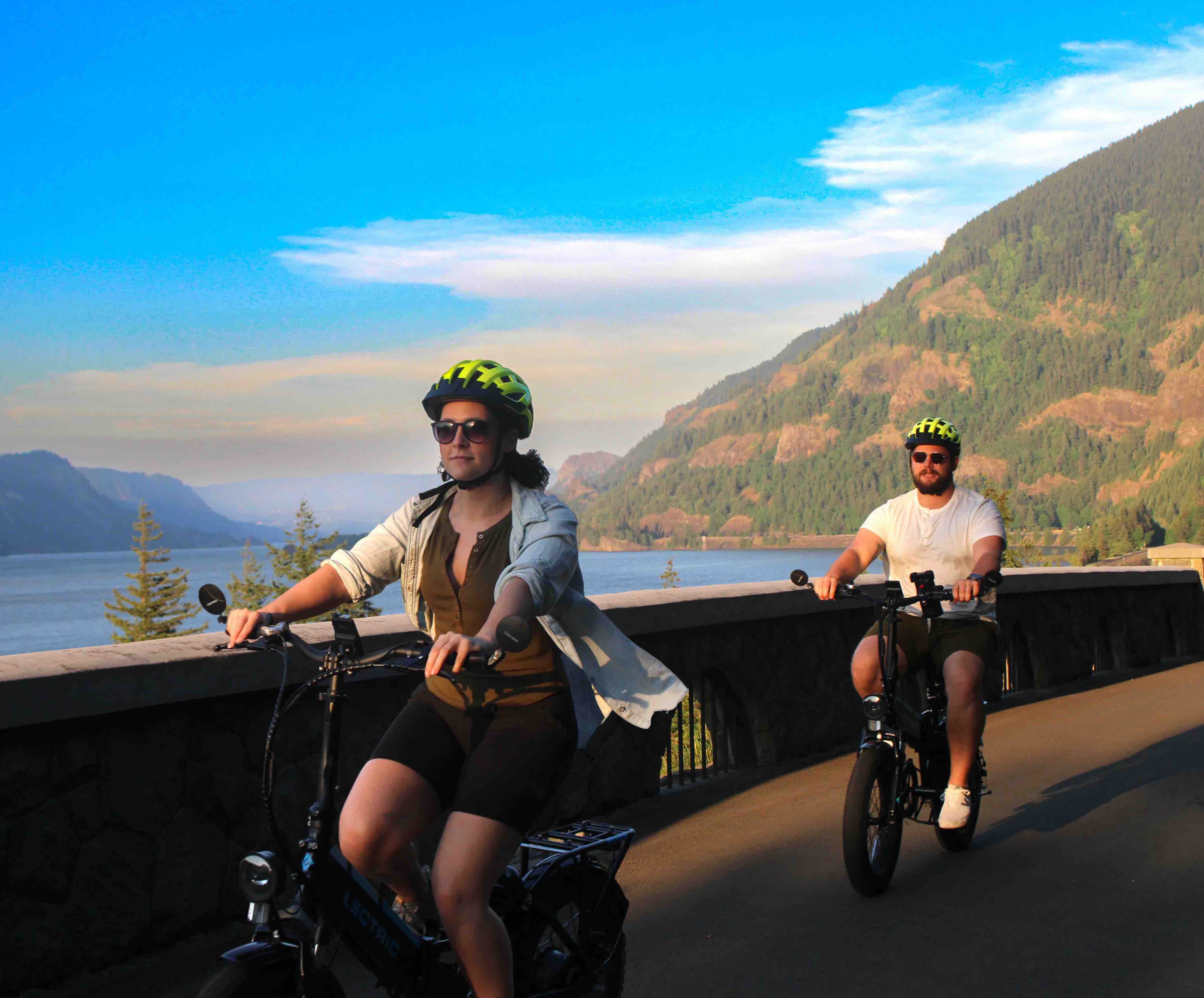
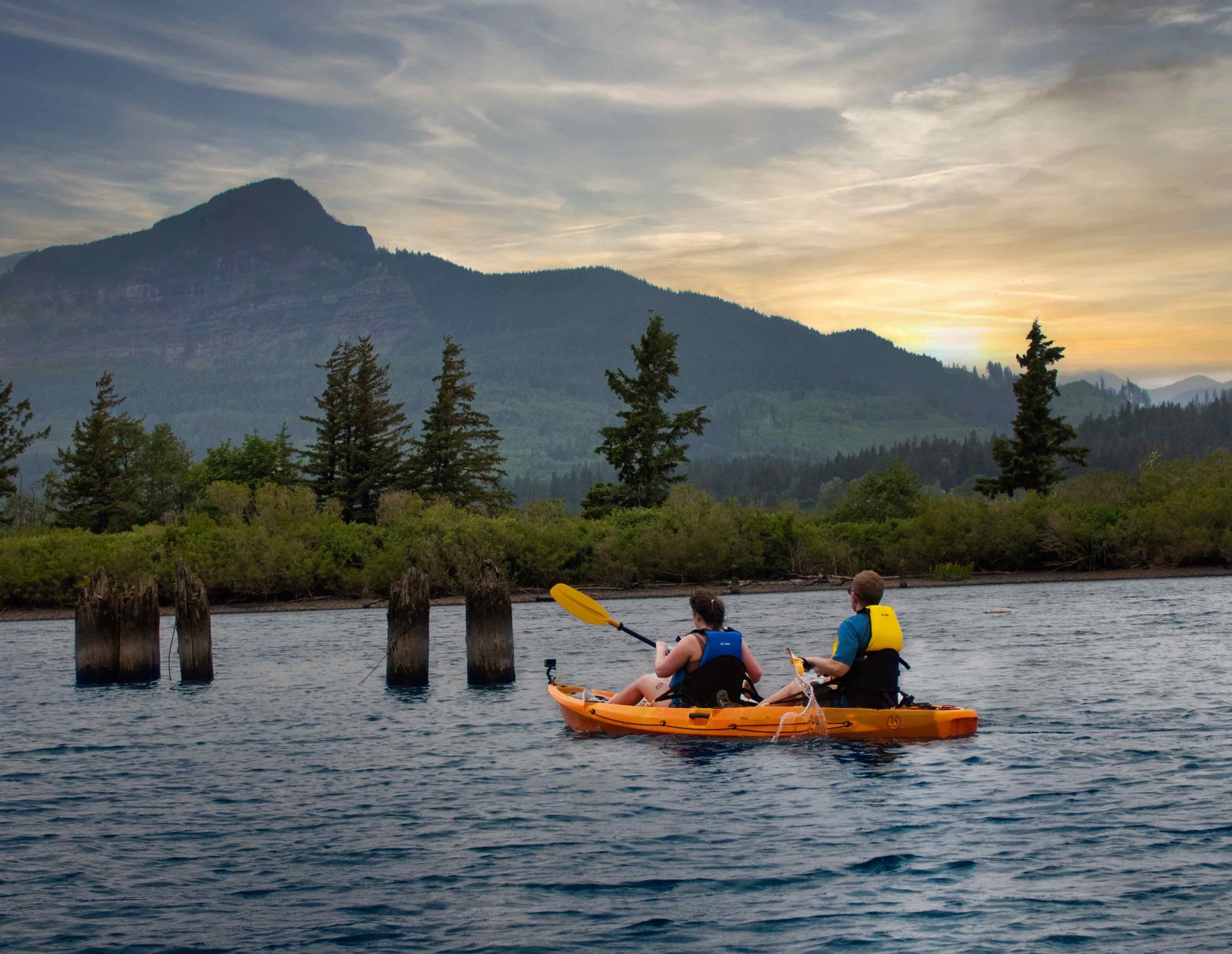
Pedal & Paddle Hood River
Located on the Hood River Waterfront, Pedal & Paddle Hood…
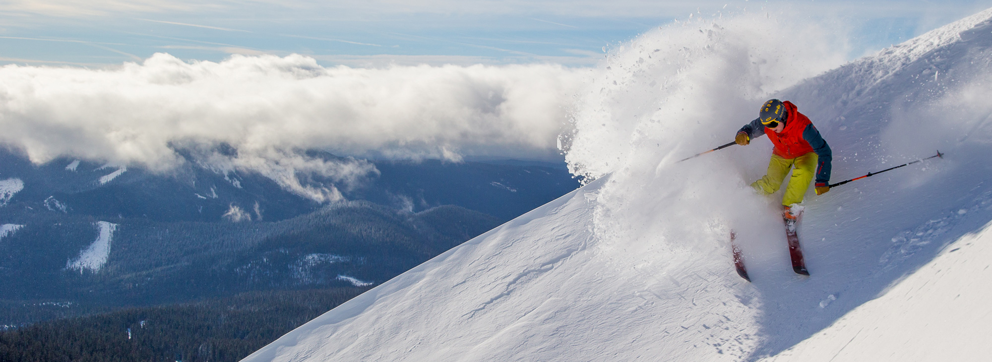
Mt. Hood Meadows Ski Resort operates on a special use permit on the Mt. Hood National Forest, offering some of the most spectacular skiing and snowboarding in the Northwest. Meadows is a full-service winter resort providing everything you need for a refreshing and memorable day on the mountain. Base facilities are housed in North and South lodges (easy access to five lifts) and includes equipment rental and demo centers, sport shops, restaurants, adult and children's ski schools and daycare. Also a satellite base lodge and skier services center at Hood River Meadows.

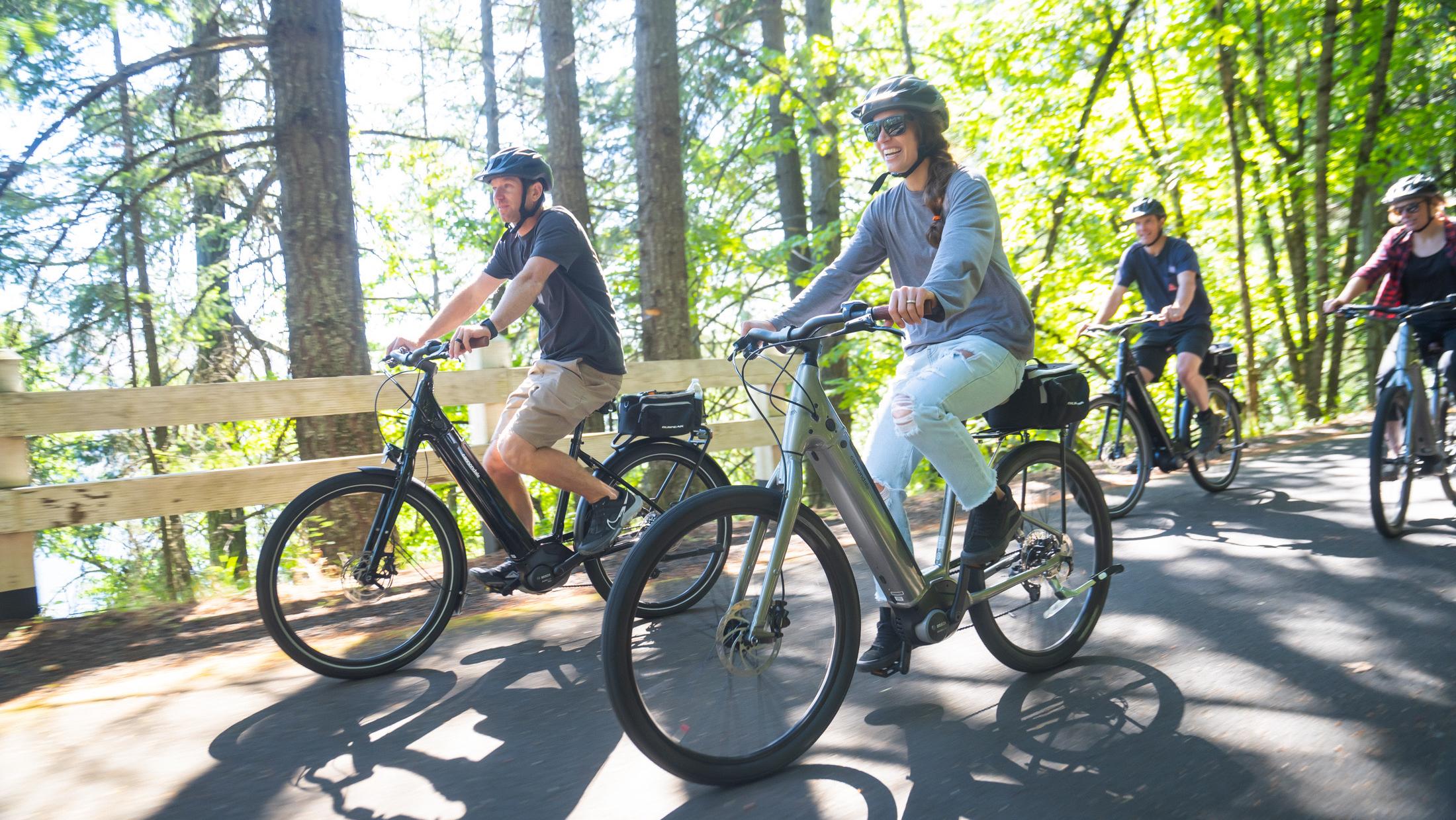
Located on the Hood River Waterfront, Pedal & Paddle Hood River provides guests with the ultimate adventure while visiting Hood River. Their kayak tours are highly rated and an exceptional way to enjoy the Columbia River Gorge. They have the best waterfront rental site which allows for safe and convenient water fun. They also offer E-bikes.
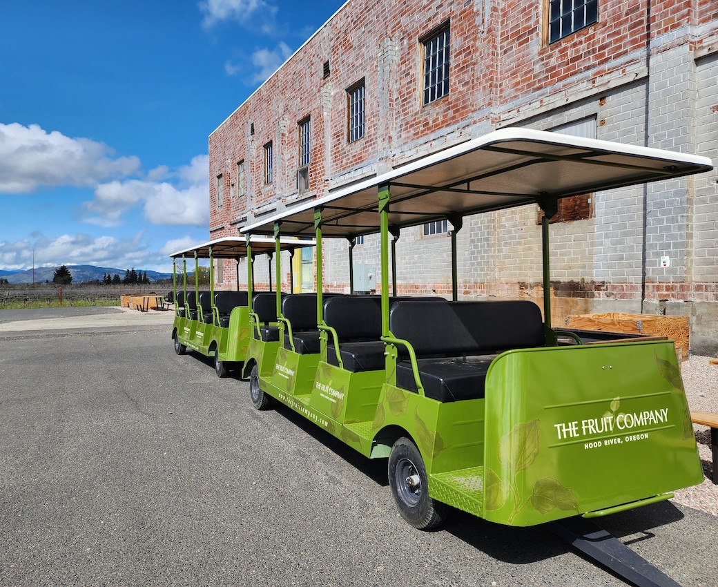
Learn about farming, from planting to harvest, while enjoying spectacular views of Mt. Hood and Mt. Adams on a fun-family ride. The Fruit Company's Orchard Tour is an informative and enjoyable experience for people of all ages, allowing you to learn about where the orchard's renowned fruit comes from and the hard work that goes into producing it. It's an excellent opportunity to experience nature and enjoy the beauty of a working orchard.
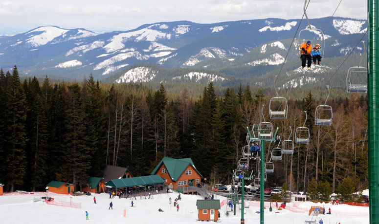
Family-friendly Cooper SpurMountain Resort specializes in presenting affordable winter fun for the whole family. Eighty percent of the terrain at Cooper Spur is beginner and intermediate, providing an ideal learning environment. The 50-acre winter playground, includes ten ski runs and two lift-served tubing runs. You’ll also find cross country skiing and snowshoeing at the Cooper Spur Mountain Resort Nordic Center, open daily in the winter.
Located on Hwy 35, 23 miles south of Hood River
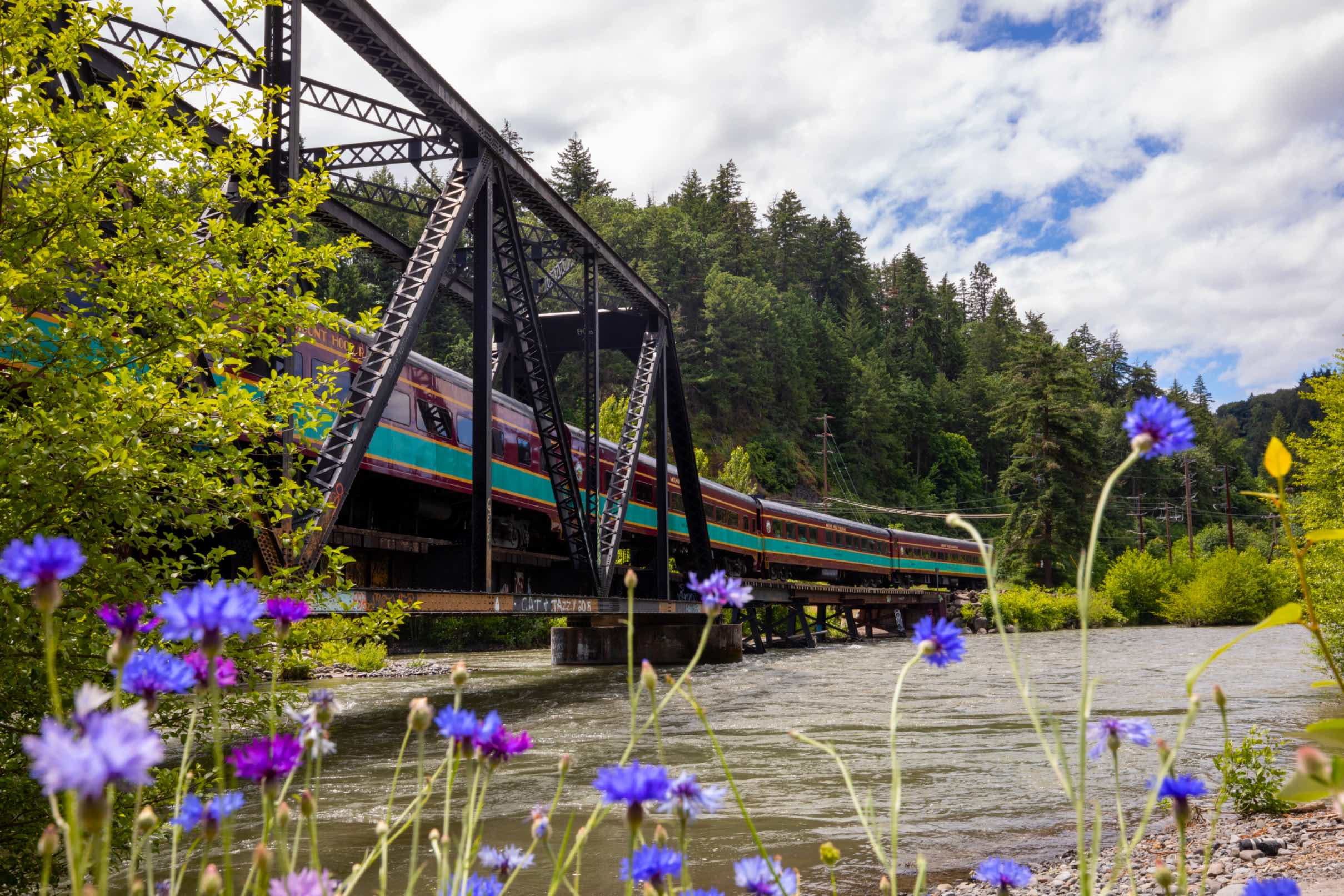
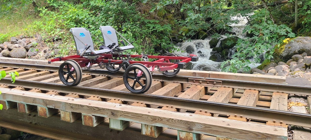
All aboard! Built in 1906, The Mount Hood Railroad is an iconic, family-friendly scenic railway in beautiful Hood River, Oregon. Recently acquired by The Fruit Company®, it continues to provide memorable tours, including scenic train rides, railbike adventures and specialty excursions through stunning forests, rushing rivers, and fruit-filled orchards. The railway has been committed to preserving the heritage of rail travel and providing exceptional customer service. The Mount Hood Railroad is a must-visit destination for train enthusiasts, families, and nature lovers of all ages.
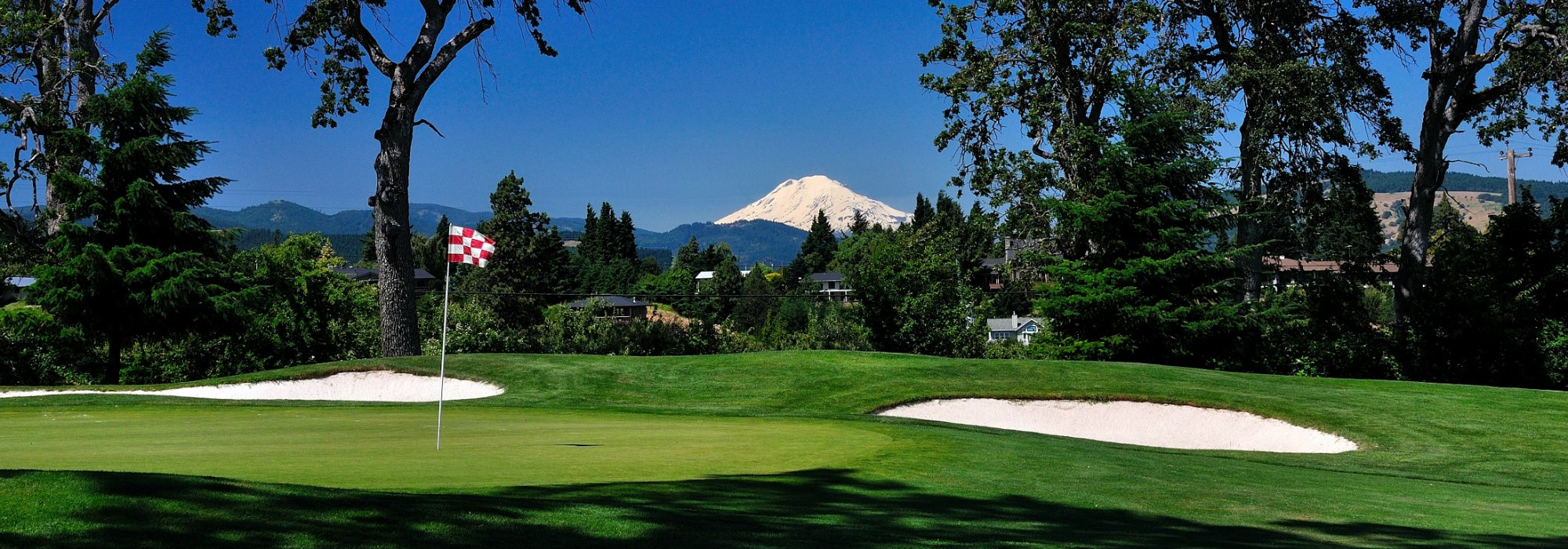
Indian Creek Golf Course is a hidden gem located where the Hood River valley joins the majestic Columbia River gorge. Tucked into the rolling hills of this valley junction and surrounded by the northern foothills of Mount Hood, Indian Creek provides great scenery and extensive elevation change.
Many go to Hood River for water sports. You could say the same thing about linksters teeing off at Indian Creek, as water comes into play on 11 holes. Though relatively short at 6,130 yards, the layout demands thoughtful shot making. This 18-hole course offers scenic views of both Mt. Hood and Mt. Adams, and features dogleg fairways, white-sand bunkers and towering stands of fir trees, not to mention meandering creeks that will challenge the best of players and some of the best-kept greens in the region.
After you’ve dominated the 18th hole, head over to the clubhouse for appetizers and drink specials. Divots Restaurant is popular with Hood River residents as well as visitors who want a satisfying lunch or dinner in a private clubhouse atmosphere.
Indian Creek is just minutes from charming downtown Hood River, where you’ll find a great selection of coffee shops, restaurants and breweries. But don’t stray too far, because Indian Creek hosts a summer acoustic music series featuring talent from all over the Northwest and the world. And if you’re looking to host a party, wedding or corporate event, Indian Creek facilities are perfect for any type of function.
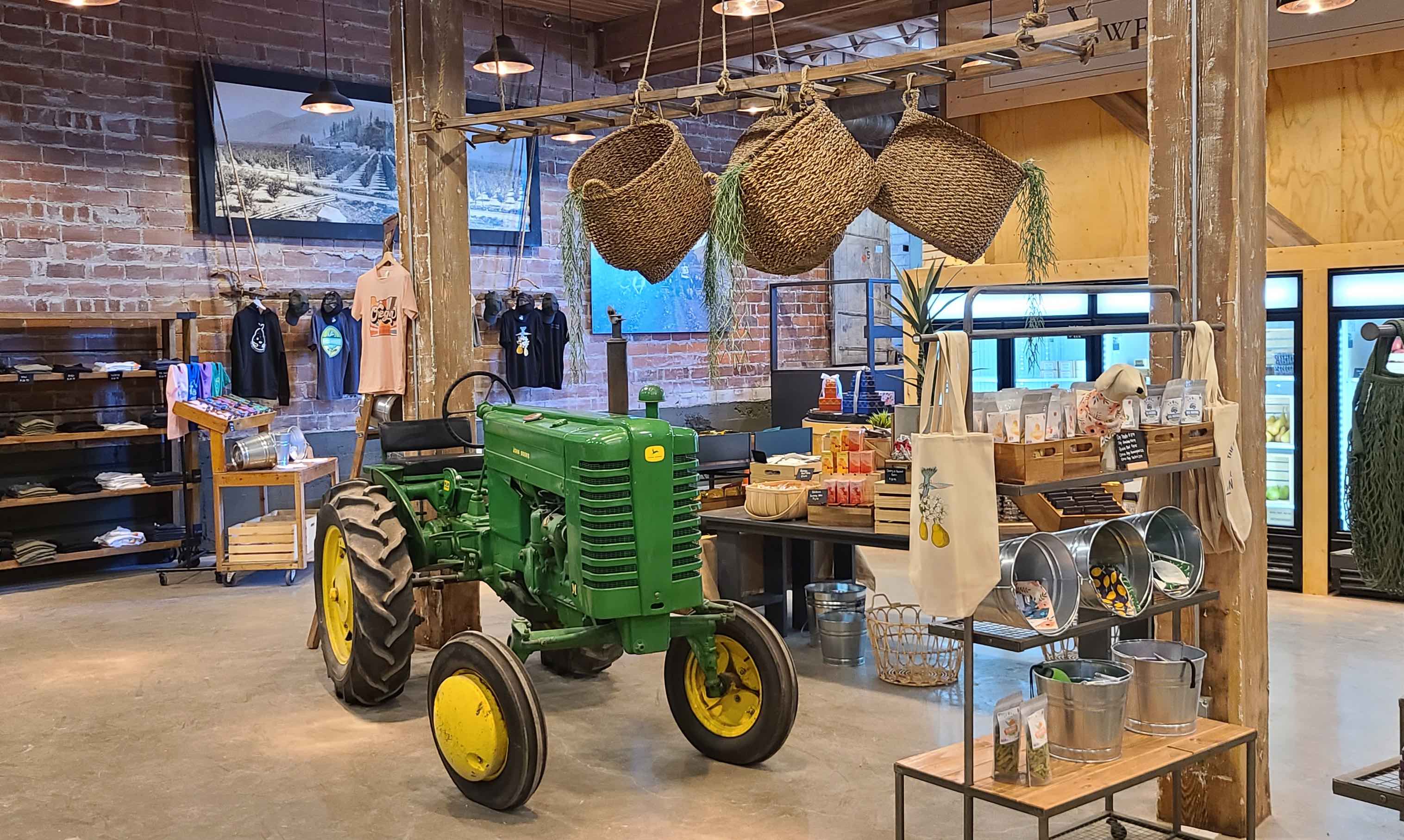
The Fruit Company, renowned for its orchard-fresh gifts sold nationwide, has successfully converted part of its historic 1940s-era factory into an elegant orchard gift shop and heritage museum. Guests of the Mount Hood Railroad, Hood River Railbikes, and motorists (stop #4 on the Hood River Fruit Loop) are welcome to come experience the deep agricultural history and taste the divine fruits grown here in beautiful Hood River.

Go behind the scenes of The Fruit Company's historic 1940s-era factory and see how their delicious fruit gifts are made. The tour begins with a brief history of the company and its commitment to producing high-quality gifts using sustainable farming and sourcing practices. The tour culminates with a gift-building station where patrons can build personalized gifts by choosing from a selection of gourmet ingredients. With knowledgeable guides and interactive exhibits, The Fruit Company's Factory Tour is an engaging and educational experience.
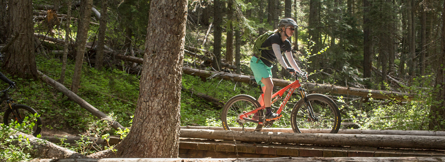
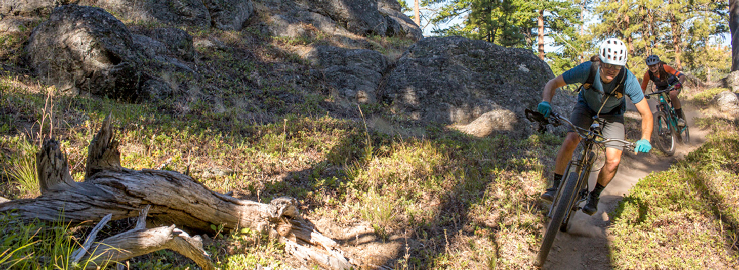
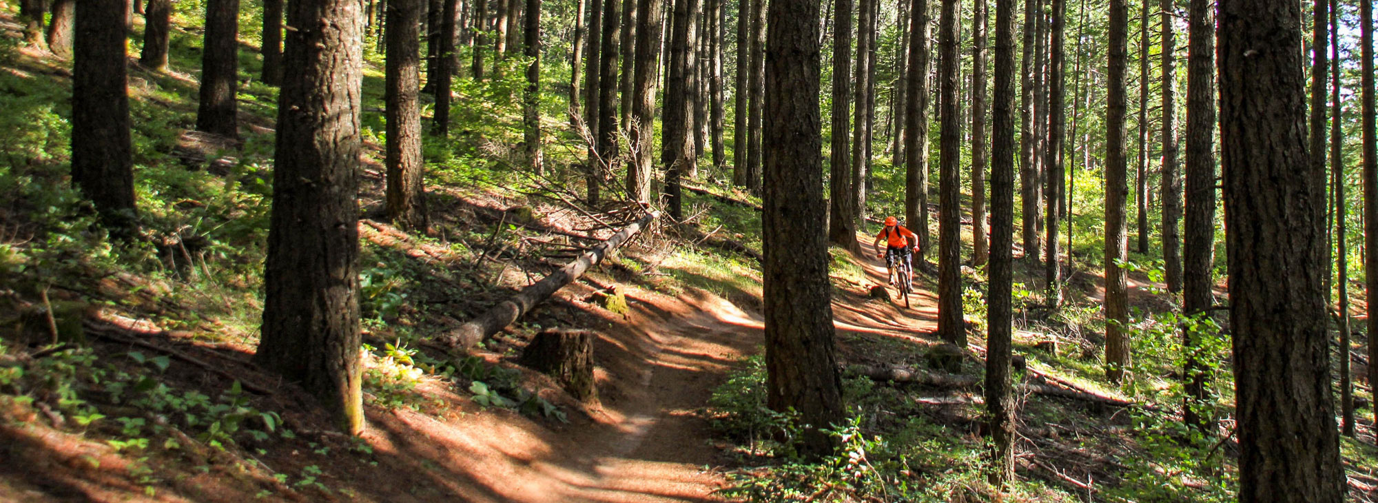
Knebal Springs may be THE classic ride in the 44Trails.org system. It seems to be one of the first trails to be clear and open in the season – these days, as early as May. It’s a classic old-school single-track ride with something for every skill level. It may be a bit of a push for beginners; intermediate riders will get the chance to put their developing skills to use; experienced riders will love the descents and be challenged by the climb on the back side. Except for some short rocky sections and some small root/brake-bump combinations on the descent, most of the trail is pretty buff and non-technical.
And, before you ride, you may want to see what’s available at some of the amazing local farms in the Parkdale area – this charming town is right near the trailhead, and some fresh produce will be quite tasty when you get to the “meadow with a view” later in the ride. Check out Kiyokawa Family Orchards, Draper Girls Country Farm, Mt. View Orchards or Mount Hood Organic Farms.
From the trailhead, ride counterclockwise on the Knebal Loop. You’ll start off with a steep climb through the forest (the pitch ranges mostly between 4 and 10 percent, with a few sections in the teens) for two-thirds of a mile – but you can just consider this a proper warmup, and groove on your surroundings out here in nature – smell the fresh air and listen for forest creatures. And, soon enough, you get your reward with a fun three-mile descent that drops 1,200 feet. Pick your way down or fly it, based on your comfort level and trail conditions – but just try keeping a smile off your face.
You’ll hit the low point of the trail when you cross the Middle Fork of Fivemile Creek. From here it’s roughly a four-mile climb out as you pass through the Knebal Springs Campground and up to a small meadow at the top that offers excellent views of Mount Hood. Pace yourself; it’s an extended effort with some steep grades, and there’s no shame in stopping for a breather or even walking a bit of the trail. It can also take some finesse to make it over small root obstacles, so stay alert.
Once you make it to the meadow, take a break, have a bite and enjoy the idyllic view; your (hard) work here is done. When you’re ready to access some more adrenaline, open up your suspension and enjoy the short descent back to the trailhead – a little less than a mile.
A few notes: These trails are popular, so say hello to fellow riders and offer the right-of-way to those climbing uphill. Take a second to pause and check in with riders instead of just blasting past; a little trail etiquette goes a long way to making everyone comfortable.
And a great thing about this zone is that you can easily access many rides from one parking area. If you still have the energy, head down the creek along Eightmile Trail for another six miles of single-track.

In the small town of Parkdale, the unexpected view of a dark wall of lava known as the Parkdale Lava Flow is a surprise to even longtime Oregonians. This dramatic 7,000-year-old flow is among the largest and youngest in the Cascades. The area can be explored off-trail, with access from adjacent forest roads.
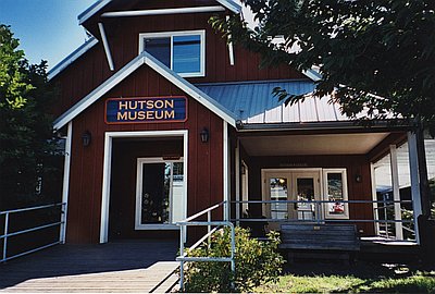
The History Museum is dedicated to the collection, preservation, and display of valuable documents, photographs, and artifacts that reflect and portray the story of Hood River County and the Mid-Columbia area.
Discover culture and history through fresh, engaging exhibits, and exciting programs. Permanent Exhibits include: Native American Culture, Early Settlers, Timber and Logging, Agriculture, Recreation, the Hood River Japanese American story, and Luhr Jensen & Sons: Where Legends Were Made.
A popular spot for kiteboarders and dogs. The size of the sandbar changes with river levels.
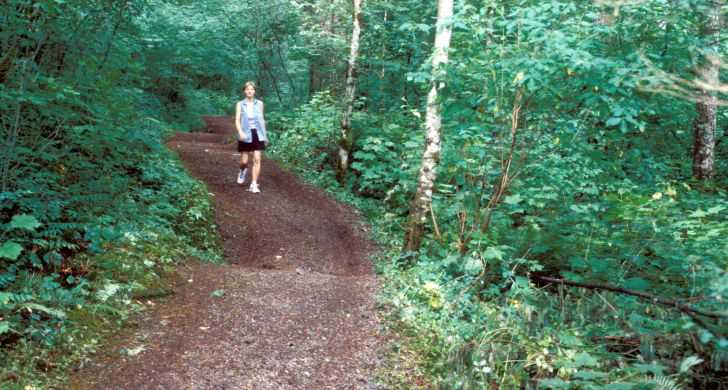
This is a short barrier free trail that travels through old growth forest near Lost Lake. The trail offers hikers an opportunity to learn more about the ecology of the area through numerous interpretive signs along the trail. The trail travels through old growth forest. This trail runs north-south between A Loop Campground and the Organization Camp. To access this trail, take the Lakeshore Express Trail #658(from the trailhead at the C Loop Campground entrance) 250 feet west to the north trailhead for this trail (#657). Turn left (south) on #657 and follow the trail to its junction with Lakeshore Trail #656.
Provides access to: Old Growth Trail #657.
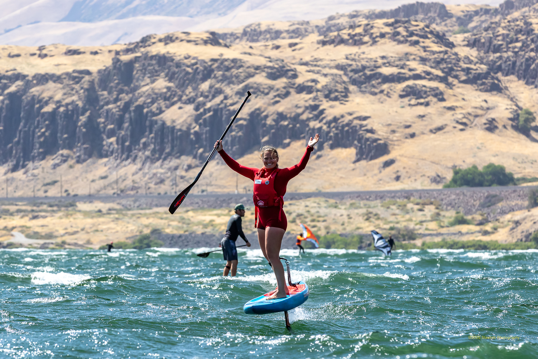
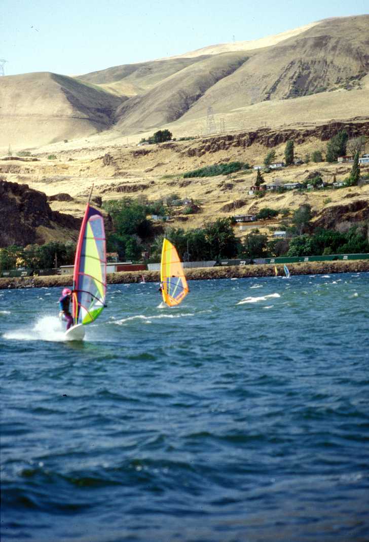
Kiteboarding and windsurfing activities dominate the Event Site, the Spit/Sandbar, and the Hook areas, located east of the Hood River, which can be accessed from Exit 63. These sites offer public access for activities as well as instruction in the watersports. Need a lesson? Authorized kiteboarding and windsurfing schools also operate in this area.
The Northwest Discovery Water Trail is a 367 mile recreational boating route on the region's defining waterways. It begins at the Canoe Camp on the Clearwater River in Idaho, follows the Snake River down to the Columbia River and ends at Bonneville Dam.
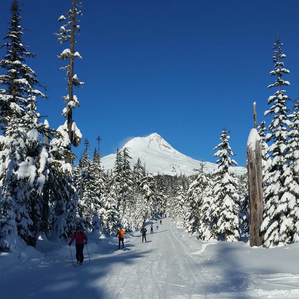
Teacup Nordic is a designated Nordic Ski Area by the US Forest Service and is operated by the Teacup Lake Nordic Club. No public entity provides any financial support to Teacup Nordic. Volunteers maintain the trails and facilities, and they organize cross country ski events and races.
Teacup Nordic offers 24 km (14.9 mi) of groomed trails. The terrain is varied; from flat and easy, to challenging hills with turns. Trails are groomed for both skate and classic skiing. Depending on snowpack, visitors can usually ski from November to May.
The Ray Garey Cabin is a heated day-use cabin for warming up, stowing extra gear or having lunch out of the weather. Memberships and trail fees have made this happen. It’s a place to meet other skiers and to feel like part of the ski community.
Visitors should park at the Teacup Lake Sno-Park on highway 35 to access the trails. Please park at 90 degress as it enables 25% more families to use the sno-park. A Sno-Park permit is required.
Snowshoes and dogs are not allowed on the the trails.
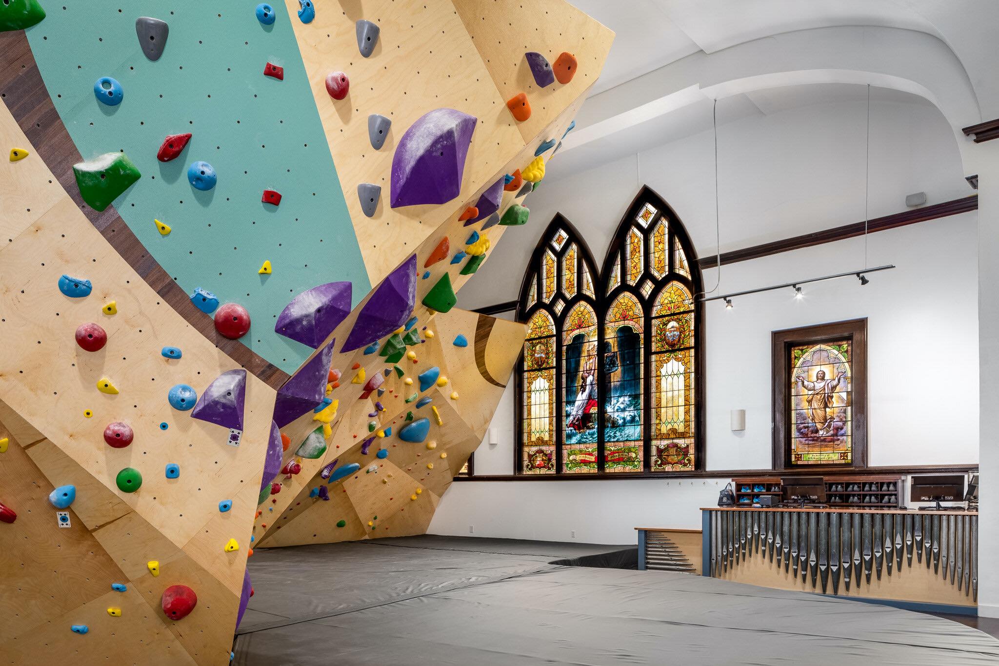
Hood River's newest and only climing gym, Brimstone Boulders is located inside an old church.
The folks at Brimstone love climbing and they believe wholeheartedly in its ability to form strong friendships and facilitate personal growth. Whether you call yourself a climber or jsut want a fun way to stay in shape for your passion, hang with your friends, or earn your beer, Brimstone Boulders is for you.
Established in the Columbia River Gorge in Hood River, Oregon in 1987, Big Winds is one of the largest windsurfing, kiteboarding and stand up paddleboarding product and accessory stores in the United States. Staff members are experienced players who are passionate about their sports and equipment and ready to offer expert advice.
Larch Mountain Picnic area is a wonderful day trip destination. This area features a picnic area with approximatley 10 picnic tables. This site provides access to Sherrard Point Trail (0.2 miles), for epic views on a clear day, and Larch Mountain Trailhead which provides access to loop hiking opportunities.
Sherrard Point is not accessible, but the picnic grounds and restrooms are accessible. The loop system of trails at the top provides great mountain biking opportunities.
Drinking water is not available.
Note: Larch Mountain Road is maintained by Multnomah County and is closed annually at milepost 10 from November through late May or early June. Use caution when driving; the road is narrow in places with limited visibility and is very popular with road cyclists.
There is one picnic table and room for 5 cars. The road to the trailhead is narrow and rough. It is a popular huckleberry picking area.
Access to: Pacific Crest National Scenic Trail #2000 and Indian Springs Trail # 435 which access Mark O Hatfield Wilderness.
Hood River County Park located on the banks of the Hood River in the scenic Hood River Valley near the base of Mount Hood's north slopes. Campground, play area, picnic area and reservable pavillion.
Waterfront Park (Exit 63) features restrooms, picnic tables, two picnic shelters, walking paths, grassy play areas, a sandy swimming beach, and a launch ramp for windsurfers and stand-up paddle boarders (no kiteboarding access at this time). Its playground hosts a larger-than-life xylophone, a 10-foot climbing wall, and natural balance beams made from boulders and logs.
Western Antique Aeroplane & Automobile Museum (WAAAM) has one of the largest collections of still-flying antique aeroplanes and still-driving antique automobiles in the country. The items on display at this museum are not only full of history, they're full of life. Aircraft, automobiles, motorcycles, tractors, military jeeps, and engines all get their day in the sun again at WAAAM.
WAAAM calls their volunteers into action the Second Saturday of every month. The action runs between 10 a.m. and 2 p.m. The huge hangar doors are opened and visitors are invited to ride in antique cars, watch antique planes take off and land, and enjoy living history. Each of these actions days has a bit of a different theme. It varies throughout the year. Stop by often and take the time to learn about and enjoy our wonderful transportation past.
Meadows Nordic Center offers up to 15 kilometers of groomed and set track through beautiful wooded trails and meadows. We have both skating and traditional striding lanes however, there is no snowshoeing at the Nordic Center.
The Nordic Center is located at the Hood River Meadows parking lot, 1 mile north of the main entrance to Meadows on Highway 35.
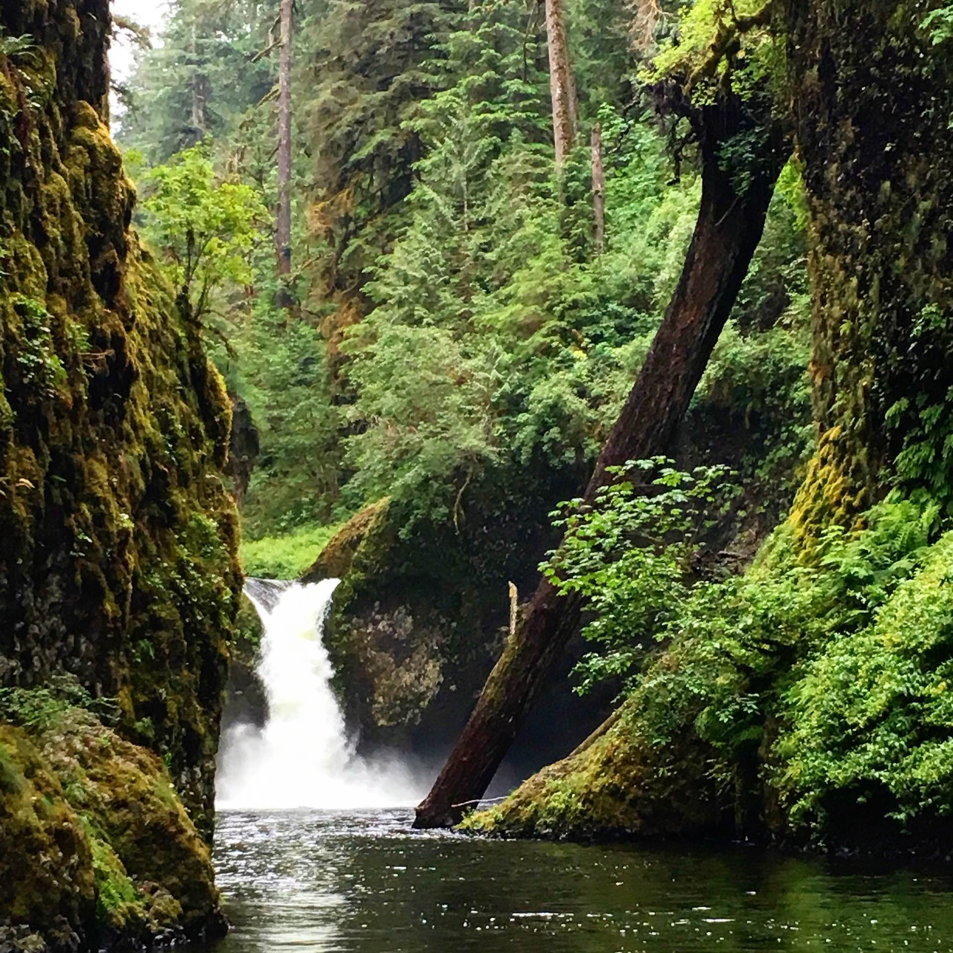
Punchbowl Falls may sound short, but it is exquisite as it drops into a large amphitheater. This is also a popular swimming hole. Like Metlako Falls, it is also along the Eagle Creek Trail #440, about 2 miles along the trail. Accessed by hiking only. Height: 10-15 feet. Type: Punch bowl. Jumping or diving is prohibited at Punchbowl Falls.
Traveling eastbound on Interstate 84, you might very well miss this tiny park. Nestled at the base of the sheer walls of the Columbia Gorge, Starvation Creek is much more than it appears. It is a feast for the eyes and feet.
Trails spreading out from this day-use park lead onto adjacent National Forest Service land and connect to the Mt. Defiance and Starvation Ridge trails. Heading east, trek along a remnant of the Historic Columbia River Highway State Trail to Viento State Park and campground. Historic Columbia River Highway and State Trail bicycle and hiking map
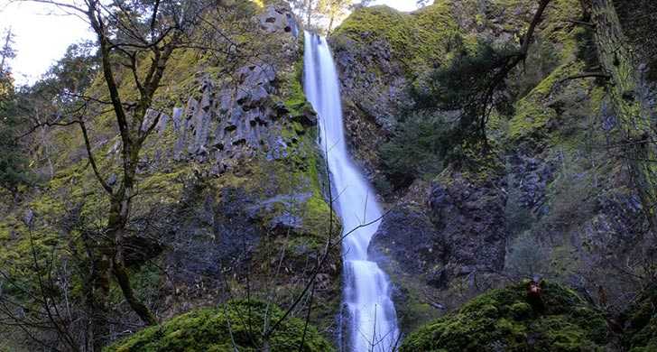
The waterfall at Starvation Creek, one of the few in this area of the gorge, is an elegant cascade admired by gorge travelers for thousands of years.

Tucker Park is located only a few miles south of Hood River and sits directly on the Hood River. The park offers campsites and a day use area with covered shelter. This is also a designated viewing area on the Oregon Cascades Birding Trail.
Situated in a stand of Douglas Fir, Herman Creek Horse Camp offers 7 sites, some with stalls, on a first come, first serve basis. This site has a turnaround and can accommodate stock trailers.
No hookups available on site.
A trailhead for Herman Creek Trail (#406) and the Pacific Crest Trail (#2000) is located in the campground. Trails provide access to the Pacific Crest Trail and Trails #406E, #447, #422, and #437 and the Mark O. Hatfield Wilderness.
Built in 1993 next to the Ries-Thompson House, the oldest remaining residence in Parkdale (circa 1900), the museum and the house are designated as a National Historic Site. Surrounded by a boardwalk, the property offers a commanding view of Mt. Hood. A USFS amphitheater hosts lectures and demonstrations, and the museum's collection of rocks, minerals, and Native American artifacts provides valuable resources for numerous areas of study.
The 3.4 mile long Umbrella Falls Trail travels from the junction of the Timberline Trail, across the Mount hood Meadows access road, passing Umbrella Falls, onto its eastern endpoint at the junction of the Elk Meadow Trail near Hood River Meadows. To reach the falls, travel on the trail about 1/4 mile northeast from the Mt. Hood Meadows Access road.
The portion of the trail west of the access road provides easy access to magnificent mountain views and floral displays and is ideal for those unable to visit the rough terrain generally found around the timberline. From the access road, the trail climbs gradually uphill, first through a forested area, then through the open meadows located in the ski area. The well defined tread leads through the open meadows whose floral displays include Indian paintbrush, cat's ears, lupine, bistort, western pasque flower and avalanche lilies early in the season. The trail crosses Mitchel Creek in 1.1 miles and terminates at its junction with the Timberline Trail #600.
The Marine Park welcomes thousands of visitors each year for sailing, fishing, camping, picnicking, and special events. The Marine Park is the perfect place to enjoy the breathtaking views of the Columbia River Gorge. Park amenities include free parking, a children’s playground, open lawns, picnic tables, public restrooms, beach, boat ramp, and marina.
While you're at the park, plan to tour the Cascade Locks Historical Museum. Within the park, you will find a footbridge over the historic locks and canal to Thunder Island in the Columbia River. The island is open to the public, and provides unique views of the Bridge of the Gods just downriver.
This stunning waterfall pours into Eagle Creek, and is located across the canyon from Eagle Creek Trail. It's a 100-115 foot plunge-type waterfall, named after the Native American goddess of salmon. It was once visible from Metlako Falls Overlook, located approximately 1.5 miles up the Eagle Creek Trail.
In late December 2016, the overlook collapsed in a landslide and the Forest Service is assessing the stability. In 2017, the area was further damaged when the Eagle Creek fired burned the area's vegetation, which had been helping to hold the rocky slopes into place.
Please stay clear of the Metlako Falls Spur Trail. It has been closed indefinitely.
- Height: 100-150 feet.
- Type: Plunge.
This trailhead provides access to Wahclella Falls Trail #436, Gorge Trail #400 and the Historic Columbia River Highway State Trail. A family-friendly option for children and adults, Wahclella Falls is one of the Gorge's most memorable waterfalls.
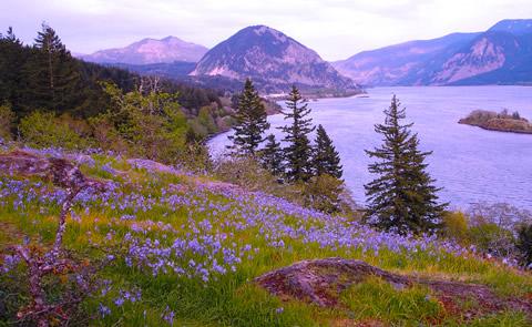
The Hood River Valley is one of the natural treasures of Oregon – both for the views over rolling terrain out to Mount Hood, and for its bounty of fruit and other crops. There’s even a driving route here called “The Fruit Loop.”
Get some different views on this loop from Hood River and back, a 59-mile route that gives you stunning views of Mount Hood while taking you through – and up above – bucolic orchards, red-barned farmlands, intense fire-blackened forests, and into hilltop scrub oak.
You won’t find services on this route, so be prepared. Park near the China Grove Restaurant and take the Indian Creek Trail, bypassing any Hood River traffic. You’ll have to negotiate a little traffic heading out of town, but once you’ve turned onto Wyeast Road, you won’t see vehicles for a good long while.
The route offers a varied menu of pavement, packed dirt and steep gravel climbing; you won’t get bored as you catch a whiff of pear blossoms or just inhale the clean scent of fresh air and fir trees.
When you descend from Gilhouley Road to Highway 35, you can cut out and head for town if you’ve had enough riding.
If you’re up for more fun – and more photos to prove what a blast you had – cross the highway for the gradual paved climb up Surveyor's Ridge Road. After a turn onto gravel, it’s time to test your bike-handling skills on a few miles of rough, rocky path and potholes as you pass through gates and intersections.
When it’s time to come back down form your mountain high, get ready for a rugged 12-mile ride down into the valley. Did we mention the views? From this direction you look out over a patchwork of fertile orchards and farm fields, down to the mighty Columbia River (can you spot any windsurfers from here?) and over into Washington. Guess what – you get a snow-capped mountain view both ways on this ride.
If you’ve had enough challenge and beauty for one ride, you get the choice again to opt out, at the intersection of Digger and Carroll – hop onto Carroll to avoid more gravel climbing by using the Mosier Tunnels bike path. Or continue up Old Dalles for additional farmland views before coasting back to Hood River, fully understanding why so many people come here and want to stay.

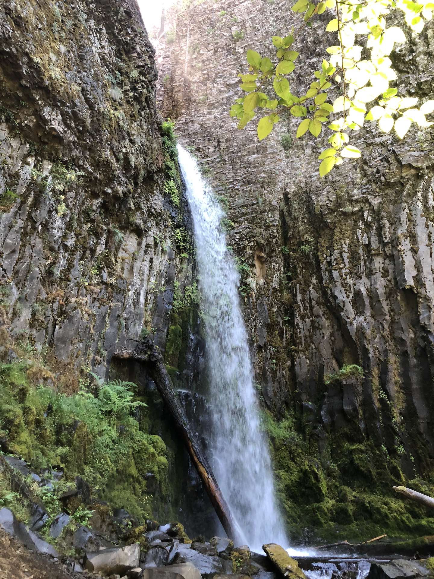
This 100-foot waterfall is less known than its rivals in the Columbia Gorge but is equally breathtaking. Hikes in this area take you through lush vegetation and critical wildlife habitat. The Tamanawas Falls area has remnant old-growth Ponderosa pines and a mix of Western red cedar and Douglas fir trees.
The trailhead is on the 1340 Forest Road at the south end of Lost Lake Campground. There is room for 5 cars and there are toilets within 100 yards. The campground is to the north. The Old Skyline Trail is a slightly more difficult trail, Its is 2.5 miles long and It connects the Lake Branch of the Cascades trail on the north side of the lake, with Jones Creek Road on the South side.
The Locks Approach Disc Golf Course is free and opens to all ages and abilities. Holes 5-9 intersect with the easyCLIMBtrail and idyllic views of the Gorge are abundant. Grab a frisbee (disc) and go!
Nestled in the awe-inspiring Columbia River Gorge, Ainsworth is equal parts waterfall wonderland, hiker's playground and camper's delight.Situated at the eastern end of Historic Highway 30, from Ainsworth to Crown Point to the west, you'll find the world's greatest concentration of high waterfalls (like Multnomah Falls).
By leaving the park on Nesmith Point trail, you'll end up with a splendid view of St. Peter's Dome, a majestic basalt monolith rising 2,000 feet above the mighty Columbia River. Hiking is definitely something you'll want to do while camping at Ainsworth State Park.
Ainsworth is located in close proximity to Interstate 84 for ease of access as well as close to a working rail line that runs through the entire Columbia River Gorge.
Campground info:
- 40 full-hookup sites canopied in a laid-back, tree-filled setting
- Six walk-in tent sites
- Designated bike-in camp area
- Flush toilets/showers
- Firewood
- Interpretive programs
Universal Access
One campsite is accessible to campers with disabilities
- Historic Columbia River Highway Trail
- Twin Tunnels
- Mosier Plateau Trail
- Memaloose Overlook Trail
- Mosier Falls
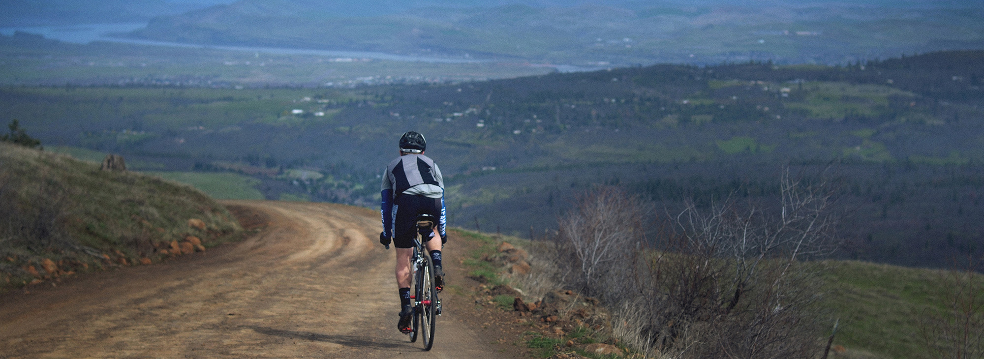
This bracing 44-mile ride carries you over alpine ridges, rocky paths, logging roads, packed gravel, river-crossings and calm, smooth pavement – and through an elevation gain of over 4,500 feet – as you cover some of the path pioneers took to settle Oregon 150 years ago. Those hardy folks had to take on whatever lay in their path, and so will you. With this variety, you will not be bored.
From Barlow Pass, start with a bit of history as you go southeast toward Keeps Mill on the historic Barlow Road/NF-3530. The Barlow Road allowed pioneers and their wagons to avoid the treacherous and expensive float down the Columbia River on the final leg of their journey west. Enjoy the exciting four-and-a-half-mile descent, and expect loose rocks, roots, ruts and soft dirt topped with fallen needles. You’ll level onto sandy doubletrack near Barlow Creek before finding pavement after a couple miles, and then alternate between hard-packed gravel, pavement and a rough, loose rocky Jeep trail.
At about the halfway point – also the lowest point of the route – is Keeps Mill Campground, where on a hot day you might like to indulge in a cooling dip in the Clear Creek swimming hole.
How you choose to cross the White River will likely depend on the time of year: a log crossing will be the best bet when the water is swift and cold, but late in the summer season, a wade through will feel refreshing, even if it’s icy. You’ll find a reasonable crossing point in the lower portion of the campground, where the roadbed angles down.
Once you’re across, start climbing. In the spring, you’ll be greeted by beargrass and other wildflowers in the meadows. The surface fluctuates some more, from a steep and rocky ascent (at a 12 percent grade!) to smooth, gently climbing doubletrack and then back to a good old gravel-grinding climb that also includes stretches of loose rock and rutted dirt.
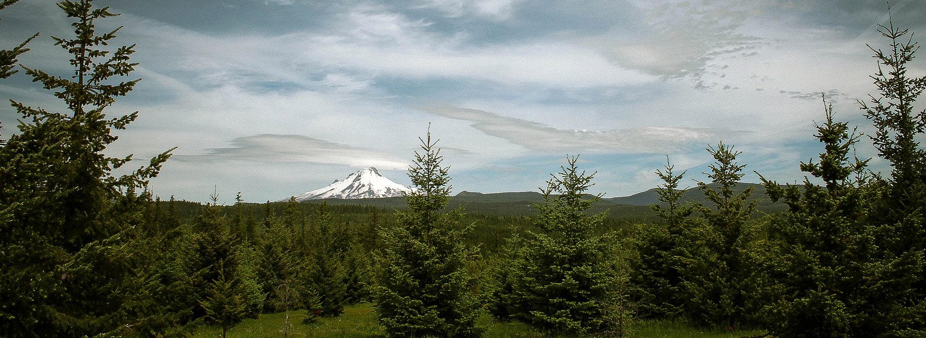
Take a minute to celebrate at mile 35, just past Bonney Meadows, because you’ve reached the highest point of the route. Now it’s time to break out your descending skills. Navigate some boulder-strewn scree, descending the ridge in a mix of shady forest and bright, wide-open vistas. Don’t forget to stop once in a while so you can take your eyes off the next 20 feet and drink in some spectacular views: to the north and east, trees march shoulder-to-shoulder up and down ridges and practically require you to stop and admire their postcard-perfect views. Mount Hood poses spectacularly to the west and reminds you why you take these epic rides. Keep your eye out for a brief, impressive view of Mount Jefferson to the south.
Roll down the ridge in a gradual descent to the Bennett Pass Sno-Park parking area, rolling smooth pavement back to the Barlow Pass parking area. Like a cycling pioneer, you’ve taken on a series of challenging terrain and surfaces, and overcome everything with only your strength and skills. Did the pioneers get a cold beverage at the end of a hard day? You should.
This ride starts from the same point as Knebal Springs; you can consider Fifteenmile Loop the same ride, but on a different scale: a bit of climbing, a long drop followed by an equally long climb; a downhill sprint to the finish. It’s just that Fifteenmile stretches out each of those segments – and puts you in an almost entirely different riding environment. This is one of the most remote backcountry trails in the area.
From the trailhead, the Fifteenmile “lollipop” route heads south across FR44 and then descends east toward Dufur. As we indicated above, this change of direction gives the ride an entirely different feel in a totally different zone.
But you start with a climb almost immediately, following Eightmile Creek for a few miles as it tumbles along through the trees, topping out at a rocky escarpment. All told, it’s about 700 feet over 3 miles, and it rolls up and down as you go – but mostly up.
Once you top out, you’ll want to stop briefly to get ready for the next bit. Adjust your helmet, straighten the goggles and tighten your shoes… and then drop into 7 miles of wildly fun downhill. It’ll be like the best, and longest amusement park ride ever; you’re likely to find yourself whooping – voluntarily or otherwise – on the way down.
As you descend, you’ll pass through Fifteenmile Campground (be polite) and over the creek; here the landscape changes dramatically. Ponderosas and scraggly white oaks replace moss and Douglas firs. Unique geologic formations bubble up out of the needled forest floor, and the trail just keeps dropping away in front of you. Wallow in the pleasure.
OK, back to reality: As much fun as the extended downhill was, the climb out is equally grueling. It’s 2,400 feet over 7 miles, give or take, and it will test even the hardiest. But make the best of it – it’s making you stronger every pedal stroke. If you’re lucky, you can stop and treat yourself to an all-you-can-eat huckleberry stop along the way.
Once you’ve worked your way out of the hole, enjoy a three-mile glide back to the trailhead; you’ve definitely earned it.
And, just like the Knebal Springs ride, you should consider a stop in the Parkdale area, either coming or going. You can get a great meal at the Crooked Tree Tavern, part of the Cooper Spur Mountain Resort, or indulge in some high-quality coffee or tea, fresh-baked goods or a meal at the Blue Canoe Café. If you’d like to stick around overnight (and ride a trail each day?), the Old Parkdale Inn is a rambling, gracious old home surrounded by lush gardens.
Notes: If you’re looking to get a shorter ride in the same area, just park at Fifteenmile Campground and ride this as a loop instead of a lollipop; it’ll cut the distance roughly in half. And if you’re doing this ride in the summer, get an early start to beat the heat on the long climb in the last half of the ride.
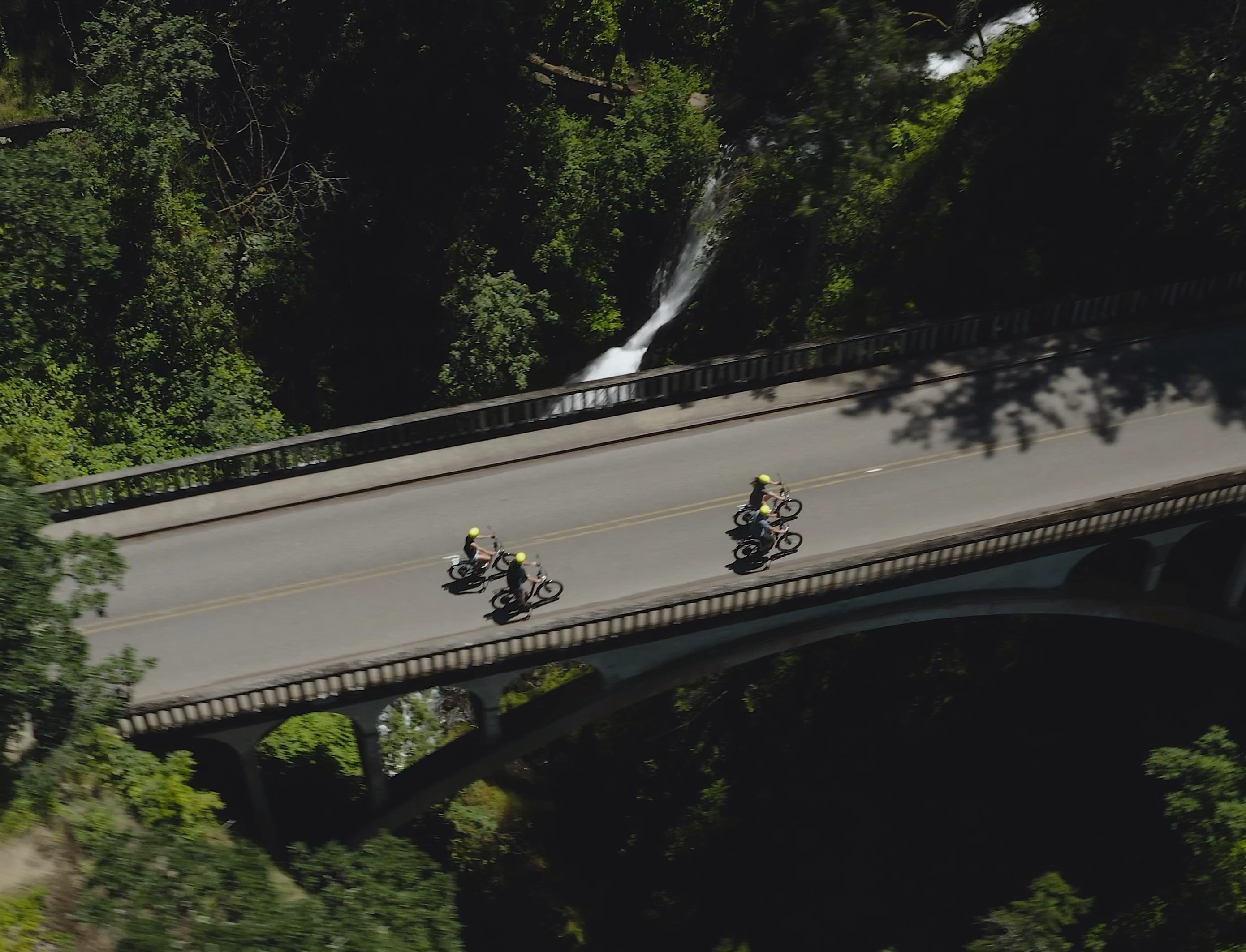
Enjoy a waterfall adventure with E-Bike Multnomah Falls. Skip the crowds and experience Multnomah Falls and the Columbia River Gorge on an easy to ride e-bike.
E-Bike Multnomah Falls offers a variety of tours. In addition to touring Multnomah Falls, they offer half and full day tours, and an E-Bike and Paddling tour.
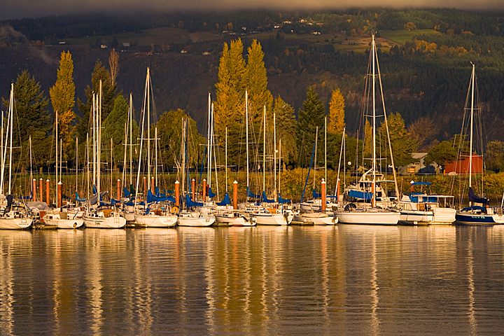
Located off Exit 64, the port's marina facilities offer a boat launch and moorage for over 150 vessels as well as kayaking, small sailing craft, community education sailing classes, and Hood River Yacht Club activities. The dock on the north side is reserved for small cruiseship vessels that visit Hood River in the spring and fall. The marina has a short-term transient dock available for travelers.
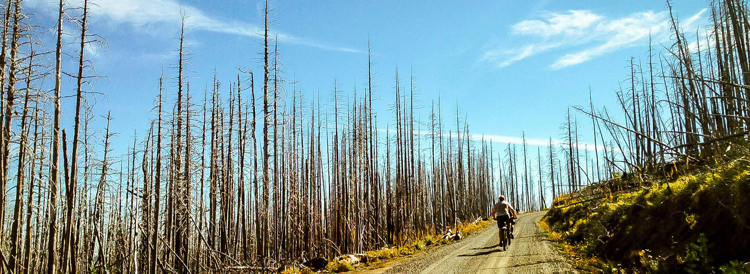
Cloud Cap Road on Mount Hood’s northeastern flank was originally a wagon road – there’s a wooden sign to prove it – that was improved through mighty effort by Chinese laborers at the end of the 19th century. At its top sits Cloud Cap Inn, built in 1889 and listed on the National Register of Historic Places. If you pedal your way up this, you’re likely to know exactly why the Inn got its name – you might even ride through clouds and pop out above them.
As you face off against the 2,531-foot elevation gain, you’ll travel through the black, standing dead-tree spires that remain from the Gnarl Ridge Burn of 2008, and as you near the top, pass into the lush verdant surroundings more familiar to Mount Hood. This moderate grade averages 4 to 6 percent over 10 miles, and the terrain trades off between maintained gravel and hard, rutted dirt with embedded rock.
As you push your way inexorably up the grade, comfort yourself with the knowledge that the original road had a stretch of 22-percent grade that not all the cars of the day could get up – the shuttle service from Hood River stopped at the bottom of that section and people had to walk up. Now here you are, cranking your way up to the Inn on the most efficient transportation machine ever devised.
At the top, you might enjoy a Mt. Hood National Forest guided tour of the Inn, which these days is used as a search-and-rescue base by a group called the Crag Rats. (Check ahead for availability and make reservations.)
If you do the Cloud Cap ride in the fall – make sure the road is still open – you might be treated to a magnificent view out over the hills and valleys of Wasco County, as the changing colors of the trees create an almost fiery landscape stretching for miles.
There are popular nearby hiking trails, plus the Cloud Cap Saddle and Tilly Jane campgrounds, so you may encounter cars, especially in the summer and fall. Because of this, as well as water bars and rocky sections, you’ll want to descend with due caution.
And once you finish, you’ve joined a long line of adventurers that stretches back more than 120 years. Take a minute to think about that.
Note: Cross or MTB tires (33c-40c) are recommended. You can find food and water at the Cooper Spur Mountain Resort.
This is a parking and starting area for the Boy Scout Lodge with room for about 25 cars. It is located on the west side of Highway 35 about 200 ft. south of White River West Sno Park. No trailer parking. There is a boyscout lodge nearby with facilities. Trails are not groomed.
The Hood River Aquatic Center features year-round fun and educational activities for everyone! The center offers a therapy pool, swim lessons, water aerobics, lap swim, and a party room. During open swim, floating mats are available for use in the deep end, as well as a basketball hoop, slide, rope swing, and zip line.
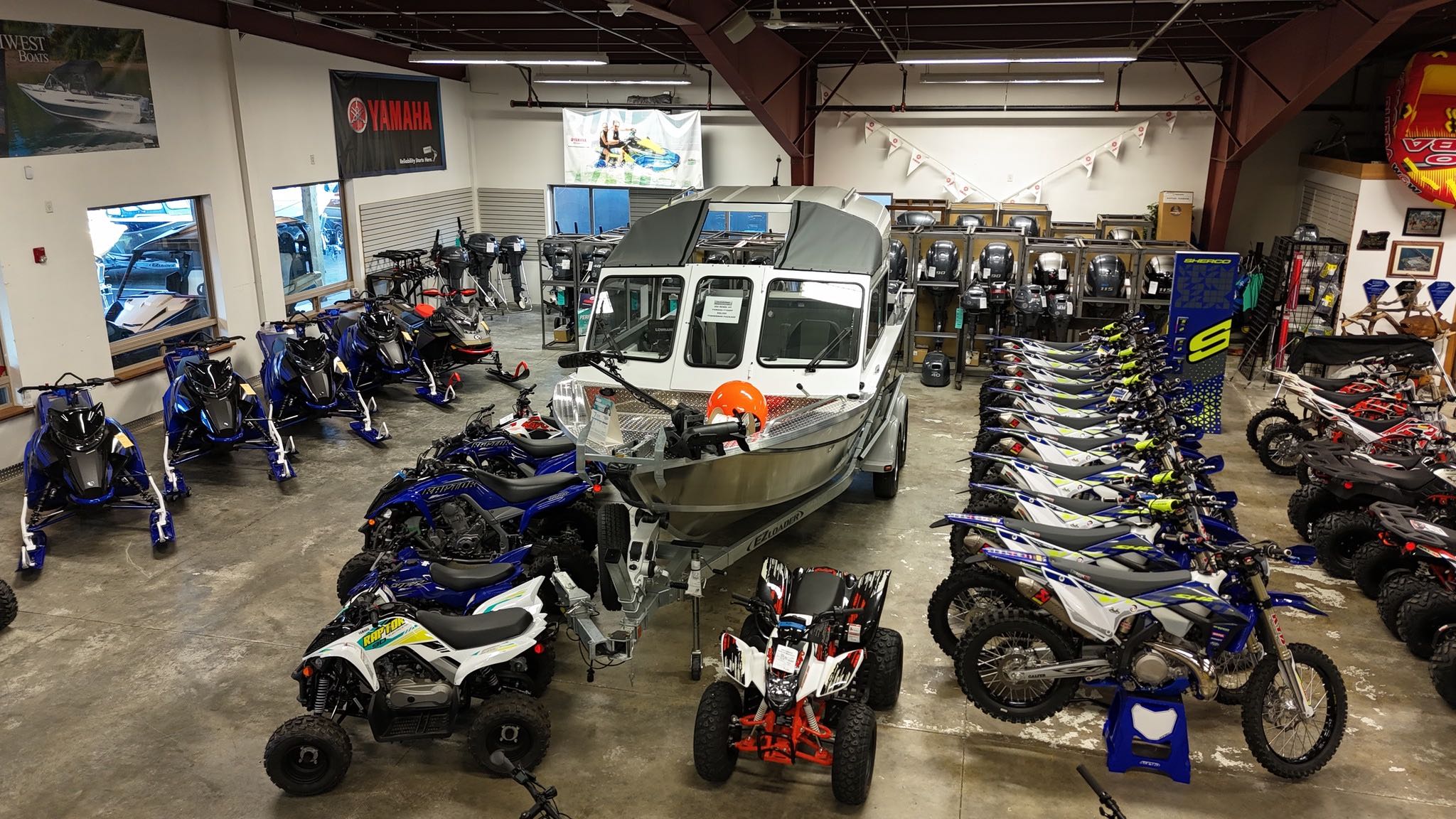
Family owned multi-line PowerSports & Boat dealership passionately managed and operated to provide a huge toy selection, an amazing experience, best value & first class service.
We are dealers for ALCOM, CFMOTO, Kawasaki, Kayo, Sherco, Triton Trailers and Yamaha. Compare all of our available-to-order manufacturer models, and check out current manufacturer promotions for rebates, sales events, and discounts.
We sell ATVs, Boat Engines, Boat Trailers, Cargo Trailers, Cycle Trailers, Electric Bicycle, Equipment Trailers, Generators, Go-Karts, Motorcycles, Scooters, Sport Utility Trailers, Trailers, Truck Trailers, Utility Trailers, Utility Vehicles and Watercraft. Shop in-stock new inventory for sale and our used inventory. Browse our full inventory to see everything we have in stock, new or used.
This classic example of a horsetail formation along Horsetail Creek can be viewed from a turnout on the Historic Highway.
Height: 176 feet. Type: Horsetail.
See Horsetail Falls Trailhead for more information.
Provides access to: Wyeth Trail #411 and is the easternmost end of the Gorge #400 Trail.
Wyeth Trail #411 accesses Mark O Hatfield Wilderness.
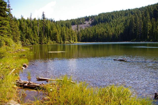
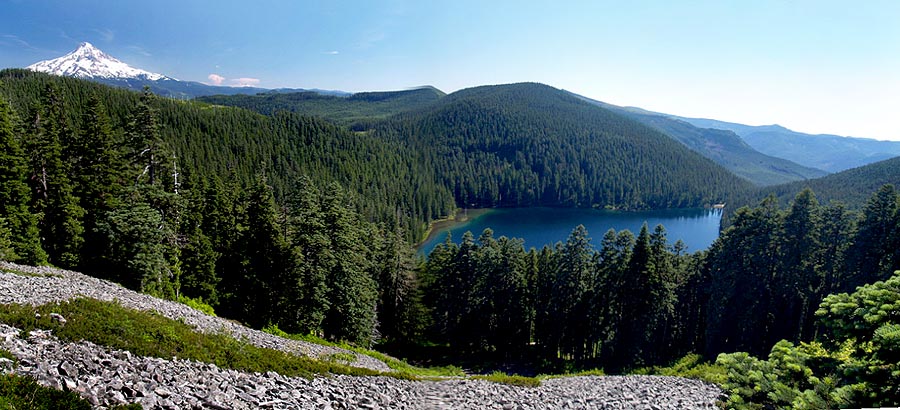
You can find the heart of Mount Hood's beauty and wildlife at Lost Lake. Photographers praise Lost Lake's unrivaled vistas, birdwatchers flock to see riparian and high-elevation birds, and nature lovers bask in old-growth forests and abundant wildflowers. With its flat, easy shoreline trail, the area offers hiking, swimming, fishing, boating, and camping. Motorcraft are not allowed.
An easy drive-up viewpoint of the entire picturesque Hood River Valley, this small park is handicapped-accessible and provides parking, restrooms, and picnic tables, so the entire family can relax and soak in the panoramic views from Mt. Hood to Mt. Adams. Park facilities and interpretive signs offer geological history of the Hood River Valley. The view features more than 15,000 acres of orchards and vineyards, and the fruit trees in bloom in spring offer a photo opportunity not to be missed.
Post Canyon is actually one of the original gravity networks in the U.S., and it has aged exceedingly well. Over time an enthusiastic group of local trail builders has populated these forested hills with a plethora of features, from perfectly bermed turns to steep roll-downs.
As a result, this destination has grown and matured into a rich network of single-track that will challenge an experienced rider with a variety of trails. The dizzying array of riding choices lets you push yourself as far as you'd like to go — drop by for a quick one-hour ride, or commit to a full-day adventure that will leave you drained but ecstatic after you drop back down to the trailhead. From the top down, there are nearly 3,400 feet of vertical descent.
Post Canyon’s lower elevation and location along the east side of the Cascades mean that it opens before many others trails in the state. It’s frequently at its best in early spring and late fall. Mid-summer can be hot and the trails get loose, so instead head up to the single-track around Mt. Hood in July and August.
Start at the Seven Streams Staging Area, where you’ll get a nice warmup along Flume Creek. Then you’ll depart the valley as you ascend toward the Family Man Staging Area. The climbing options begin to include both roads and trails, so be sure to stay in touch with your nav device as you work your way up 8 Track, Riordan Hill Road, Sexy Beast and the occasional moto track.
As you huff your way up, remember that date with gravity – the climb is a piece of work, but it’s mitigated by a nice balance of technical challenge and efficiency. Don’t pass up the scenic views on the way up – you can call it a rest or call it appreciation of nature, your call.
The ascent crests at Dirt Surfer, a relatively new trail that packs plenty of gravity-induced fun into 2 miles. Enjoy multiple drops, gnarly roots, sweet berms and some quick, punchy climbs before you emerge into a speed section that delivers plenty of air time. A short break up the road offers the chance to compare notes and adrenaline levels with your friends – but soon you’re back to business with a short, sharp drop that will regain your full attention.
OK, that happened. Now take on Borderline, a half-mile segment with a series of berms that will fully demonstrate the joys of centrifugal force. From there you’ll navigate (literally – keep an eye on your nav device) some ups and some downs that lead to a technical, fast ridgeline downhill bomb with drops, G-outs and roots.
You’ll be deeply grateful to our planet’s gravity after you track through the last few giant berms and get dumped out near your car. No doubt, you didn’t waste any of that early effort getting to the top. Now it’s time to hit the town for some cold beverages, a hearty post-workout meal and some slightly exaggerated tales of your adventures on the trails.
From watersports to wonderful vistas, the Columbia River Gorge provides just about every type of outdoor recreation you can imagine. Find maps and current conditions on this page, or explore what we have to offer by clicking links on each of our sites, found below.
Know Before You Go:
- Note the latest conditions on trails, campgrounds, and recreation sites below.
- Check if any of our Alerts and Notices affect your plans.
- Learn about Accessible Adventures in the Gorge.
- Get tips to tread lightly, follow trail etiquette, and Recreate with Respect.
A great spot for a picnic lunch, the Eagle Creek Recreation Area also provides access to a variety of trails, including the extremely popular Eagle Creek Trail #440. The picnic area is wheelchair accessible and has an accessible picnic shelter. There is a 20 foot trailer length limit in this recreation site due to tight curves in recreation area.
The recreation area also provides access to the following: Eagle Creek Trail #440 and Ruckel Creek Trail #405 (both lead into Mark O Hatfield Wilderness), Gorge Trail #400, Wauna Viewpoint Trail #402 and the paved Historic Columbia River Highway.
The Cascade Hatchery is also at this location and during the fall, visitors can view chinook and coho salmon spawning at Eagle Creek. Please protect spawning salmon. Look but do not touch. Do not throw rocks or poke salmon with sticks and stay out of the creek during spawning season.
The salmon spawning season is here and the USDA Forest Service, Columbia River Gorge National Scenic Area provides a new way to watch all the action as the Chinook (King) Salmon prepare to spawn. Fisheries personnel have placed an underwater webcam in a pool of Eagle Creek, a tributary to the Columbia River, where Chinook are gathering prior to spawning. While Chinook Salmon are present now, later in the autumn you can also observe Coho Salmon.
The Triple Falls viewpoint is on Oneonta Trail #424, 1.7 miles from Oneonta Gorge Trailhead. It is of triplet form, not triple as the name implies, consisting of three separate rivulets of Oneonta Creek. Accessed by hiking only. Height: 100-135 feet. Type: Segmented.
Head out to John B. Yeon Scenic Corridor to one of the dramatic and secluded waterfalls in the area. A family- and dog-friendly 2.2-mile hike leads to Upper McCord Creek Falls, actually a double falls that cascade 64 feet over mossy basalt.
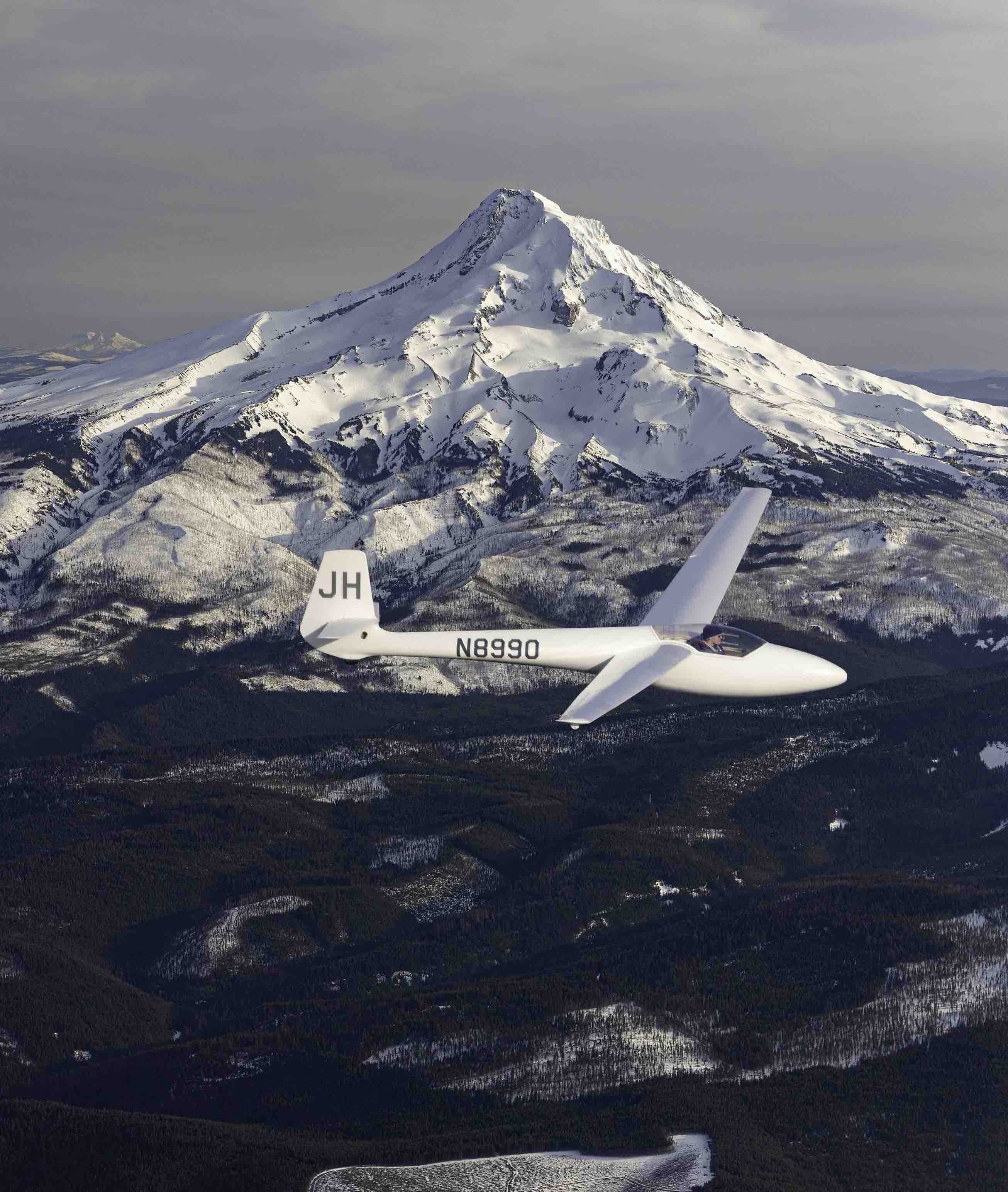
Hood River Soaring is passionate about sharing their love of soaring with experienced and aspiring pilots and with the people who live in and visit the scenic Hood River Valley. Hood River Soaring offers glider rides to the public and glider rental, towing, and instruction to their members. Their youth program makes glider pilot training affordable and accessible to the next generation who live in the mid-Columbia Gorge.
Experience the grand beauty and geologic wonders of the Columbia River Gorge from a two-passenger glider.
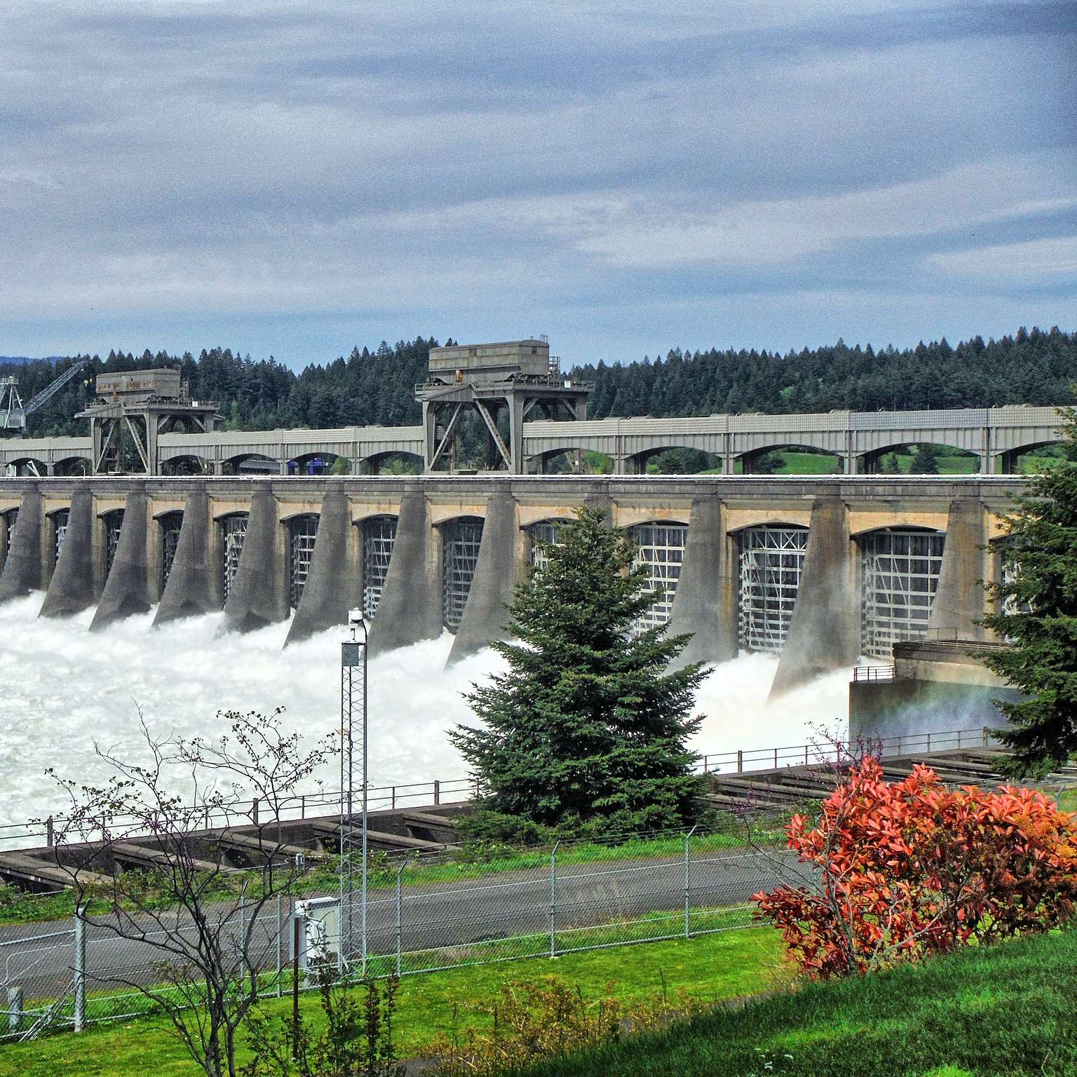
The U.S. Army Corps of Engineers operates and maintains Bonneville Lock and Dam for hydropower production, fish and wildlife protection, recreation, and navigation. Visitors can experience the operation of two hydroelectric powerhouses, watch migrating fish traveling upstream at the underwater viewing rooms next to the fish ladders, and see salmon and sturgeon in the fish hatchery.
Our first-class skate park has expanded to include a BMX track, permanent restrooms, and a playground area. A nine-hole disc golf course begins on the corner of 20th Street and Wasco. It is a challenging course through trees and other terrain.
This thunderous waterfall is in the Tanner Creek area. East Fork Falls can also be seen streaming above the descent from a vantage on the west side of Tanner Creek. Accessed by hiking only. Height: upper falls 15-25 feet; lower falls 50-70 feet. Type: Tiered

The mission of the Hood River Valley Parks + Recreation District is to provide recreational opportunities to the citizens of the Park District, with focus on the youth of the community. Facilities and programs will be developed and maintained to provide safe and economical recreational environments for all users.
Hood River Valley Parks + Recreation District is your resource for where to go, what to do, and how to do it. On rainy days días iluviosos and sunny days días soleados, Hood River Valley Parks + Recreation District can point you to fun places to play, meet, and learn.
They have 40+ years of experience providing a gem of multifaceted aquatic, trail, and park recreation opportunities to the 20,000+ people we serve in the Hood River area. Think family picnics and honing your swimming skills. They help people find balance with a pace set for longevity and well-being—healing, conquering fears and growing connections for youth, seniors, and Latinxs.
Not to be confused with the Punchbowl Falls on Eagle Creek, Punchbowl Falls in Dee is Hood River County’s newest and most scenic park. Located at the confluence of the East Fork and West Fork of the Hood River, the short quarter-mile trail above Punchbowl Falls winds along a basalt cliff above the aquamarine river flowing below. The trail leads to a beach right above the confluence.
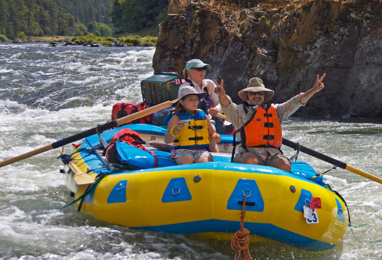
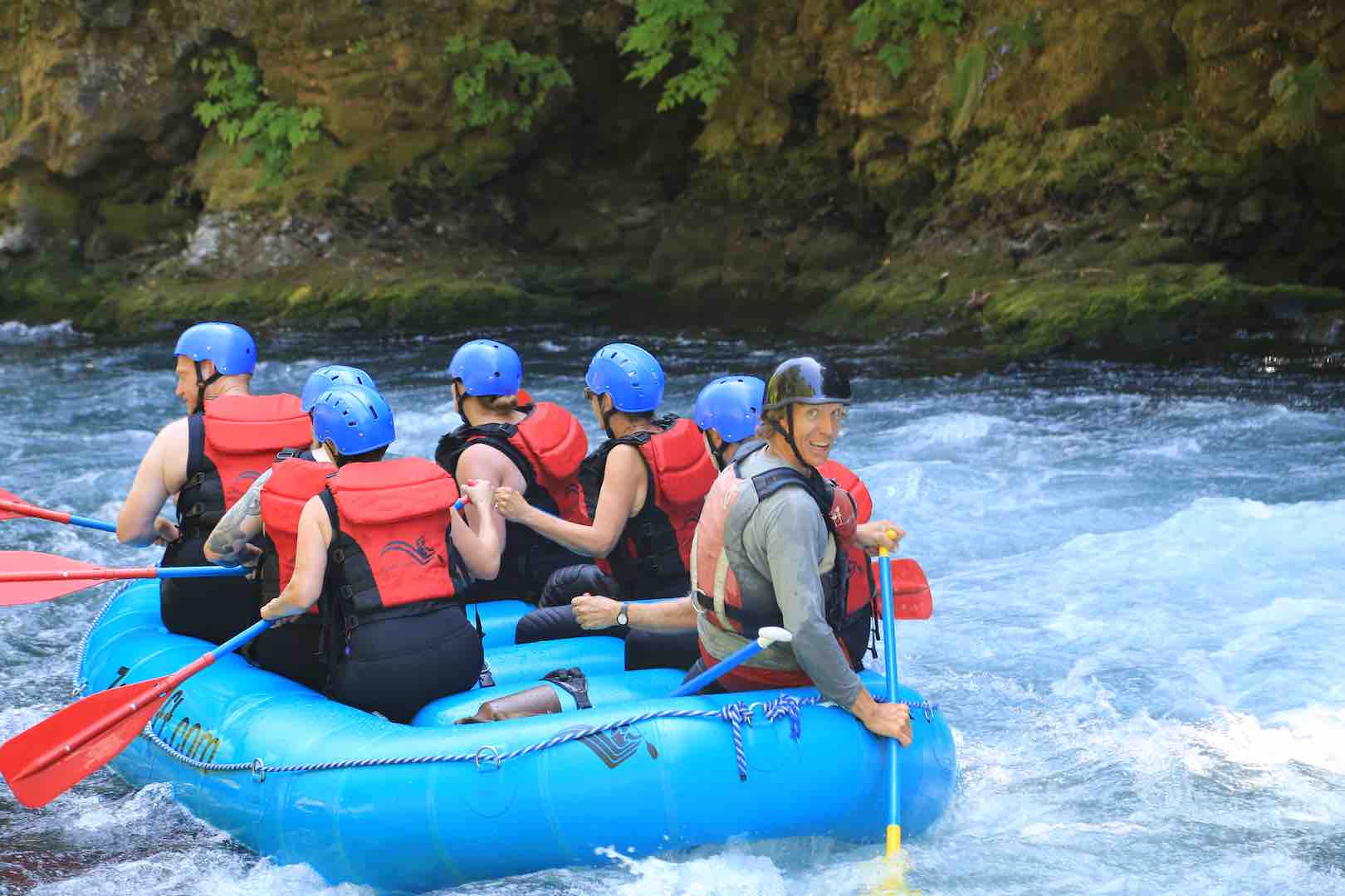
Northwest Rafting Company offers rafting and kayaking trips in the Pacific Northwest and a few select international destinations. Their favorite trip is a 4 day wilderness trip down Oregon's famous Rogue River. They also offer a number of shorter trips near their world headquarters in Hood River, Oregon.
Provides access to: Pacific Crest National Scenic Trail #2000 which accesses Mark O Hatfield Wilderness to the south, and the state of Washington to the north across the Columbia River.
The trailhead is located at the Bridge of the Gods in Cascade Locks, OR the largest city adjacent to the Pacific Crest Trail (PCT). This site is also the lowest elevation on the PCT. The trailhead includes a parking area and restroom that is open during the season.
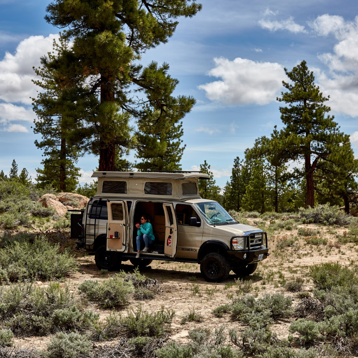
The ROAMERICA’s self-contained and fully-equipped campervans are perfect for exploring the Pacific Northwest and beyond. Each vehicle is maintained to the best possible standards. Standing room inside, full kitchen, 2 beds, 5 seat belts, car seat friendly, free roadside assistance and we provide all the gear! Want to see Crater Lake, Whistler, Tofino or The Redwoods? No problemo! Travel anywhere in the US and Canada!

Established in 1923 the club is located in the original farmhouse from the late 1800s. The front nine is a relaxed stroll with Mt. Hood in the background while the back nine is an adventure through the trees on the upper side of the 300-acre property, with magnificent views of the surrounding vineyards and orchards. A tasting room for local winery Phelps Creek Vineyards and the Clubhouse Bar & Grill offer refreshment and more stunning views.
Nestled along the stunning Columbia River Gorge, this campground is picturesque and designed with accessibility in mind. Guests can enjoy various outdoor activities, including hiking, birdwatching, and family picnics, while benefiting from accessible paths and facilities. The park offers a peaceful setting for everyone, with the tranquility of nature at your fingertips.
Open year-round, Viento State Park is ideal for families, nature enthusiasts, and travelers.
Appropriately enough for a park in the blustery Columbia River Gorge, the park's name, pronounced vee-EN-toe, is Spanish for wind. Just an odd coincidence, actually. In this case, the Viento comes from the first letters of three railroad tycoons - Villard, Endicott, and Tollman -who put the first railroad in the area.
Viento has a day-use area with easy access to the Columbia River and some of the best windsurfing in the Gorge. There's a great picnic area right next to a wonderful, babbling creek.
A one-mile, fully accessible trail from Viento to the Starvation Creek waterfall takes you along a section of the Historic Columbia River Highway. Now a hiking trail, there hasn't been auto traffic here in more than 50 years. Historic Columbia River Highway and State Trail bicycle and hiking map
Campground info
- 56 electrical sites with water
- 18 tent sites with water nearby
- Flush toilets and hot showers
- Interpretive programs
- Universal Access: Two campsites accessible to campers with disabilities.
Please secure your valuable when enjoying parks.
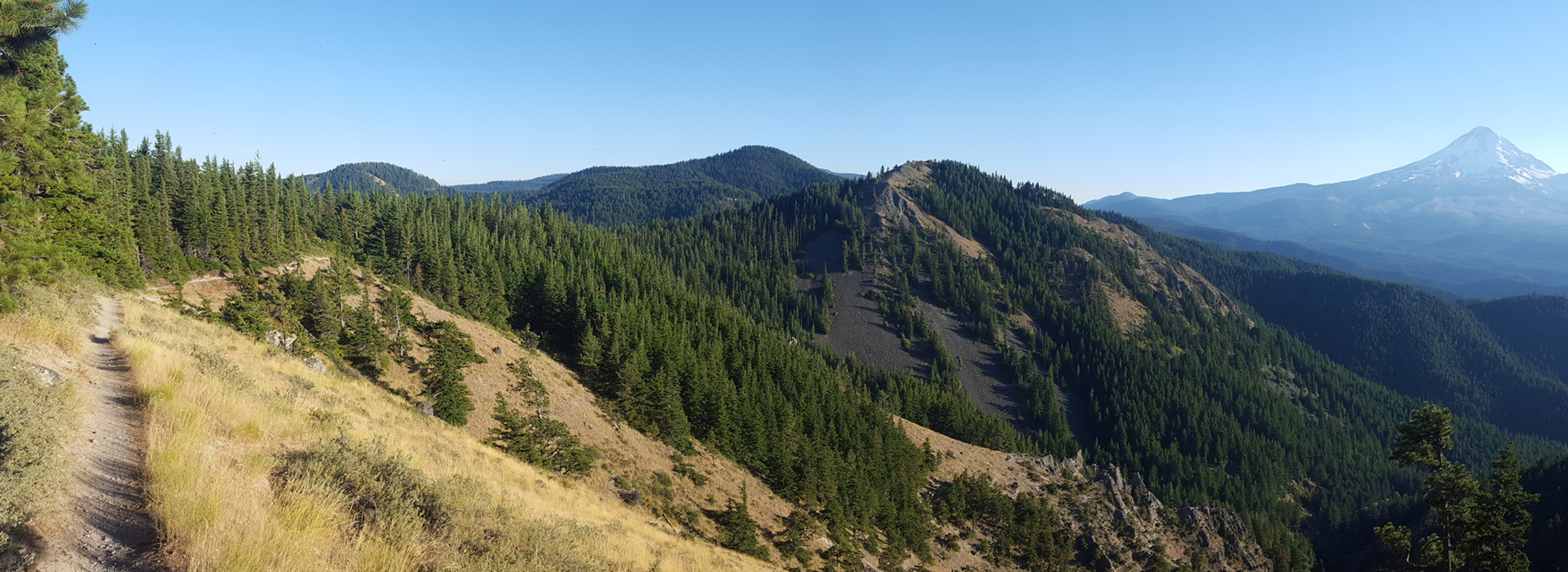
Mount Defiance (4,960') is the highest point in the Columbia Gorge.
The Museum is located in one of three original locktender’s houses, built in 1905, in the Port of Cascade Locks Marine Park. The Museum overlooks the original lock and canal built in the late 1800’s. The first steam locomotive built on the Pacific Coast is on display here, the Oregon Pony Engine. At this National Historic Site you’ll find fascinating artifacts, information and photographs. A must-see if you’re interested in historic waterways and locks, the once-fierce Cascade Rapids, railroads, fish wheels, sternwheelers and steamboats on the Columbia River, or Cascade Locks History.
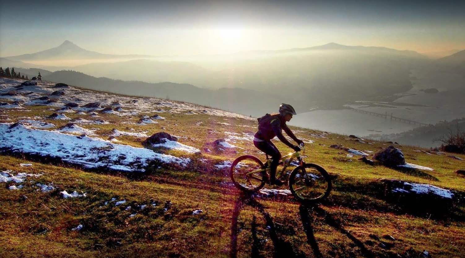
Photogenic and majestic, Mt. Hood is one of the iconic spots (and images) in Oregon. In the mountain-biking world, Surveyors Ridge occupies a similar status – along with the likes of the NUT and the McKenzie River Trail, it’s one of the routes that define single-track riding in the state. And for good reason: besides all the goodies you’d expect from an epic trail itself, it gives you some of the most fantastic views of Mt. Hood you can find – you’ll see the peak from angles most people will never experience.
The trail is like an all-you-can-eat buffet of your favorite riding: lung-busting climbs, rolling traverses through alpine meadows full of wildflowers, and a rocket descent down to the finish that will test your mettle. The highlight, though, is the unparalleled views of the back side of Mt. Hood.
You can do Surveyors Ridge as a one-way or out-and-back, but we’ve set it up as a loop for you, incorporating the Dog River Trail too. To get started, park your vehicle at the Oak Ridge trailhead just off Smullin Dr. on the east side of Highway 35 near Parkdale. You’ll begin with an easy warm-up spin, heading south on the highway toward the Dog River trailhead. Highway 35 has generally decent shoulders, and this is a regularly trafficked stretch for road bikes, too, so motorists are used to seeing riders.
Once you hit the Dog River Trail – just over 4 miles up the road, where it curves west – you get an easy break-in period... right until you hit the switchbacks. Inhale plenty of that high-mountain, forest-scented air; you won’t really have much choice, so enjoy it. But the terrain gives you a great preview of the rest of your ride: after the trail levels out a bit and the climb becomes a bit more Zen, you plunge deep into the forest, with lush ferns and scattered flowers on the forest floor and towering Douglas fir trees rising to the sky all around you.
Find your rhythm and tune in to your surroundings. The sense of splendid isolation is exhilarating, and you’ll start to feel that endorphin high. And that’s a good thing, because you’re not close to being done working. Cross a small bridge over the Dog River, and then set to work earning the descent you’re going to get later on. Between miles 6 and 10, pick up 1,600 feet, at grades that are regularly 10-percent-plus, and occasionally hit 20 percent and more. Stay strong, because about the time you think your legs are going to explode, here comes a pleasant descent through forest that’s thick with firs and pines, letting you catch back up to yourself like a mid-morning coffee. As you tackle one final upward push, be on the lookout for people riding the trail the other way – if they’re coming, they’ll be coming fast.
The end of the Dog River climb brings you to the Surveyors Ridge trail. After a short segment of Road 1720, use the Super Connector trail to reach the ridgelineSurveyors is named for, and get ready to be wowed. The trail dips, swoops and rises like the open ocean in a storm, and be sure not to miss opportunities to stop and smell the wildflowers – and get that frame-worthy shot of Mt. Hood bracketed by massive timber. At the crest of a short climb at mile 18.5, take a break to wander out to an old fire lookout; from here you can often see the volcanic lineup of Cascade Range peaks stringing north on the Washington side of the Columbia River.
OK, time to change riding modes: set your dial to DzNerves of Steel.dz Go for the gusto on a drop down and across jagged basalt; you’re going to be tested here, and so will your rims. While you’re holding on for dear life, you need to also pay attention so you don’t miss the left turn onto the Oak Ridge descent; this is actually an opportune time to take a little break to let your hands and arms rest, and your brakes to cool –because it’s just about to get even better. If you love – really love – descending, get ready for a new romance. This brief but heart-throbbing drop will either have you laughing crazily, or screaming like a little kid on a roller-coaster. Enjoy the switchbacks, which were blasted out of the hillside with dynamite. And if you’re really in the zone, see if you can make it all the way to the bottom without putting a foot down. Most can’t.
Once you survive the plunge you get a little dessert, in the form of a stretch that serpentines through the valley floor before you return to your car.
Time to take a breath, take stock... that was one stupendous ride. Do you even remember the views of Mt. Hood?
No amenities. Trailhead is a pull out along the road that will accommodate 4 to 5 vehicles. Road to trailhead is rough and dusty. Provides access to: Mt Defiance Trail #413, Bear Lake Trail 413A, Wyeth Trail #411. These trails access Mark O Hatfield Wilderness.
Ride with a local guide.
Greg Galliano, an experienced mountain biker and photographer, assembled a team of guides to create Hood River Mountain Bike Adventures. Along with his wife Melanie, they offer unique experiences for riders of all skill levels. With extensive knowledge of the local trails and expertise as IMBA-certified instructors, the team ensures enjoyable rides by simplifying the routes and highlighting picturesque locations. They provide a comprehensive mountain bike guiding and rental service, catering to intermediate and expert riders. Located near Hood River, they offer rental bikes, guided tours, and shuttle services, accommodating various biking needs. Everyone is invited to join them on their thrilling rides.
Provides access to: Multiple trails within Mark O Hatfield Wilderness and Wahtum Lake Campground and day-use area. Note, if you are going into the wilderness you have to fill out a wilderness permit at the permit box from May 15th to Oct 15th. Provides access to: Eagle Creek Trail #440, Pacific Crest Trail #2000, Rainy Wahtum Trail, Chinidere Mountain Trail, Herman Creek Trail #406.
Up for adventure? Down for a drink? No matter your style, find your fun in Hood River.