
The Historic Highway That Became a Car-Free Adventure
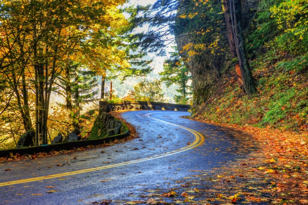
The Historic Columbia River Highway was never engineered simply to move people through the Gorge. It was built to make them slow down and look.
In the early 1900s, engineer Samuel C. Lancaster and road advocate Sam Hill imagined a highway that would work with the landscape rather than simply cut through it. Instead of forcing a straight line through the Gorge, the road followed its natural contours, curling around cliffs, slipping through rock, and opening onto one view after another. Stone bridges seemed to rise from the landscape itself. Tunnels disappeared into the mountainside. Carefully positioned viewpoints revealed towering waterfalls, dramatic mountains, and sweeping views of the Columbia River.
This road was designed for seeing somewhere, not simply getting somewhere.
Construction began in 1913, and when the first paved section opened in 1915, the road became the Pacific Northwest’s first paved highway. By 1922, the 73-mile route was complete, connecting the Sandy River near Troutdale with The Dalles.
More than a century later, that original vision is finding a new life.
As sections of the highway have been restored, some have been transformed into the Historic Columbia River Highway State Trail, a growing network of paved, car-free paths for people traveling by bike, on foot, or using mobility devices.
The result is a rare chance to experience a piece of transportation history without the traffic that eventually made the original road obsolete.
When Speed Took Over
The original highway was a remarkable feat of engineering and design. Its stonework, viaducts, tunnels, and carefully framed viewpoints quickly earned it a reputation as one of the country’s great scenic roads.
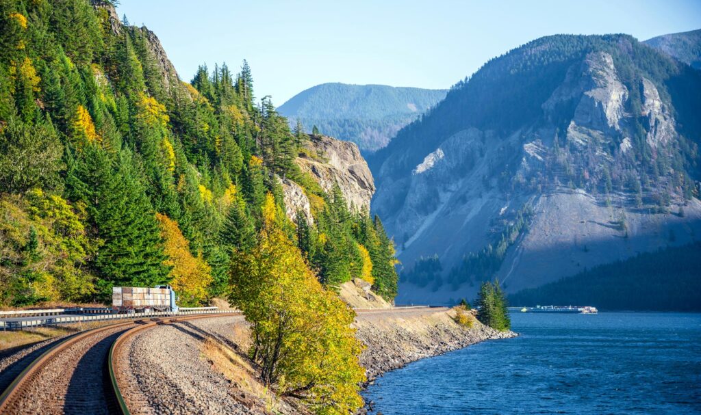
But it wasn’t built for modern traffic. As vehicles became larger and faster, Interstate 84 gradually replaced most of the original route. By 1960, the interstate had bypassed nearly all of the old highway. Some sections remained open to cars, while others disappeared beneath I-84, fell quiet, or were slowly reclaimed by the landscape.
The 4.5-mile stretch between Hood River and Mosier was nearly lost altogether.
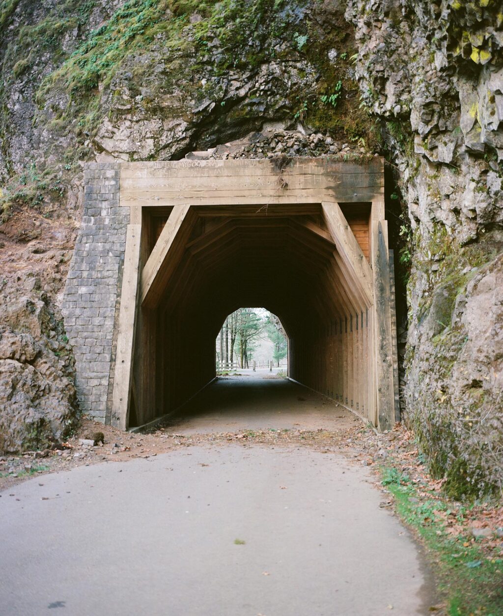
When I-84 opened, crews filled the historic Mosier Twin Tunnels with rock and closed the old highway. For decades, this remarkable piece of the original route sat beyond reach, hidden behind tons of fill and the passage of time.
Then, in the 1980s, interest in restoring the Historic Highway began to build. Workers eventually removed the rock from the Twin Tunnels, uncovering the original passage and pieces of its history, including graffiti dating to 1921. Restoration continued from there.
The Historic Columbia River Highway was designated a National Historic Landmark in 2000, and the State Trail received National Recreation Trail status in 2002.
What you’ll find today isn’t a replica of the original road. In many places, you’re traveling directly on the historic highway itself, reclaimed for a different kind of journey.
A Highway Being Reconnected
The Historic Columbia River Highway stretches 73 miles from Troutdale to The Dalles. Today, it isn’t one continuous, car-free trail. Instead, the historic route is being pieced back together through a combination of scenic roadways and car-free State Trail segments.
As of 2026, 68 of the original 73 miles are open to travel, either by motor vehicle on the Historic Highway or connecting roads, or by foot and bicycle on the State Trail. Five miles remain to complete the connection.
Some of the most interesting pieces are happening right now.
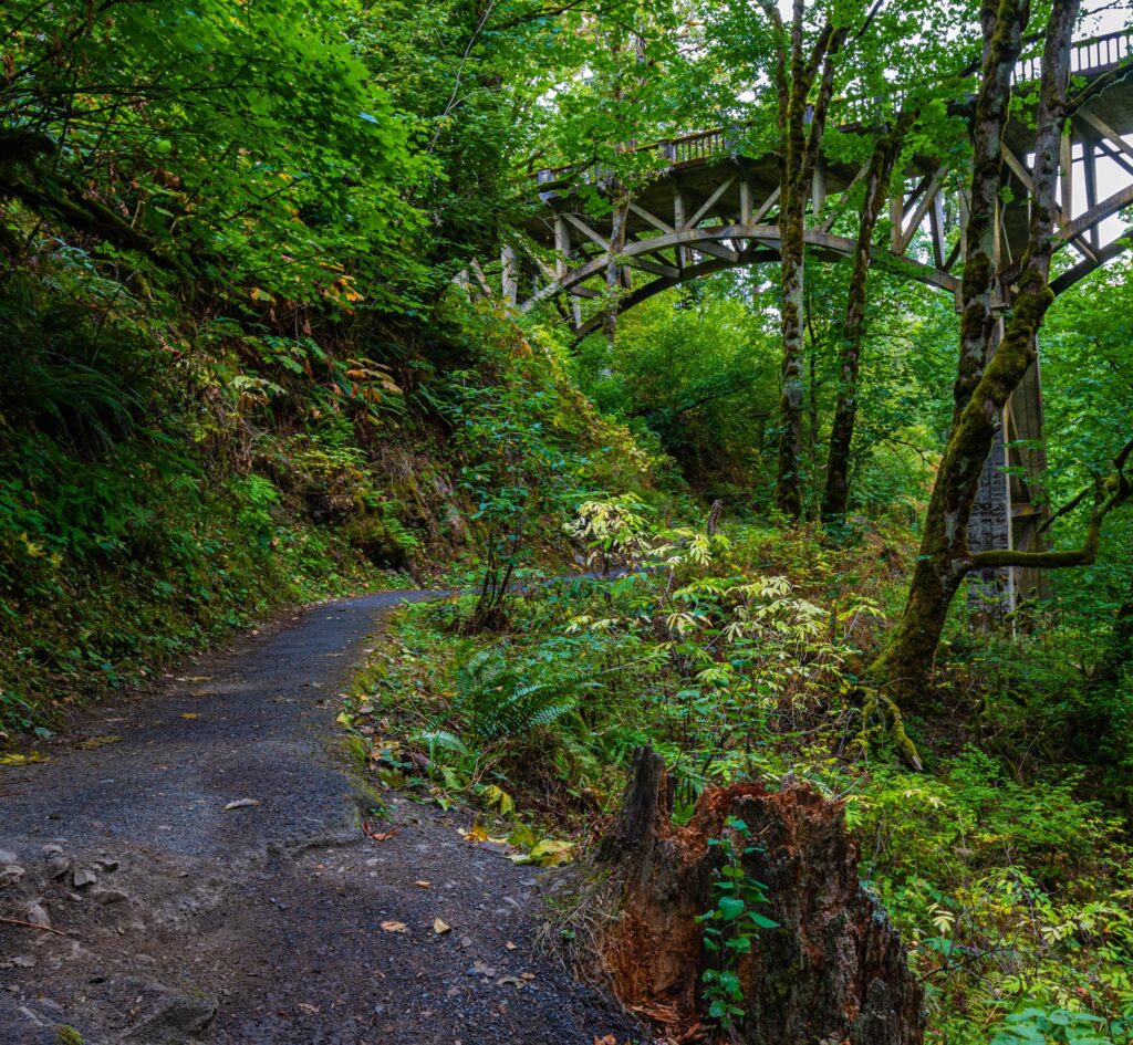
The State Trail already includes car-free sections near Bonneville, Wyeth, Viento, Mitchell Point, Hood River, and Mosier. The nearly six-mile stretch between Wyeth Trailhead and Viento State Park carries hikers and cyclists through deep forest, past waterfalls, and across the impressive 500-foot Summit Creek Viaduct.
Then there’s Mitchell Point.
The new 655-foot Mitchell Point Tunnel opened in March 2025, recreating the dramatic experience of the original highway tunnel. Five openings, known as adits, bring light and fresh air into the passage while offering glimpses of the Columbia River Gorge. The tunnel is part of a 1.5-mile State Trail segment open to hikers and bicyclists.
The connection isn’t finished yet. Construction is underway on the remaining 0.7-mile gap between Viento State Park and the Mitchell Point Tunnel. Once complete, it will connect the existing trail and create a longer, continuous car-free route for people walking, biking, and rolling. ODOT currently expects construction to continue through 2026.
Another connection is also in the works east of Mitchell Point. ODOT is designing a separated bicycle and pedestrian crossing beneath I-84, with construction anticipated to begin in early 2027. Future work will continue the effort to connect the trail toward Hood River.
The story, in other words, is still being written. More than 100 years after the original highway was completed, Oregon is continuing to reconnect its pieces and open them to a new generation of travelers.
Hood River to Mosier, Without the Cars
For travelers staying in Hood River, one of the easiest ways to experience the Historic Columbia River Highway State Trail starts just outside town at the Senator Mark O. Hatfield West Trailhead.
From there, the 4.5-mile Twin Tunnels Segment runs east toward the Senator Mark O. Hatfield East Trailhead near Mosier. The paved, car-free trail is open to hikers, bikers, and wheelchair users, making it one of the most accessible ways to experience this stretch of the historic highway. E-bikes are also allowed. And the scenery changes beautifully along the way.
The trail slips beneath a canopy of Douglas firs, weaving through rolling green hills before the trees part and the Columbia River comes into view. The route rises and falls gently, revealing glimpses of the Gorge before drawing you into the cool, shaded passage of the restored Mosier Twin Tunnels.
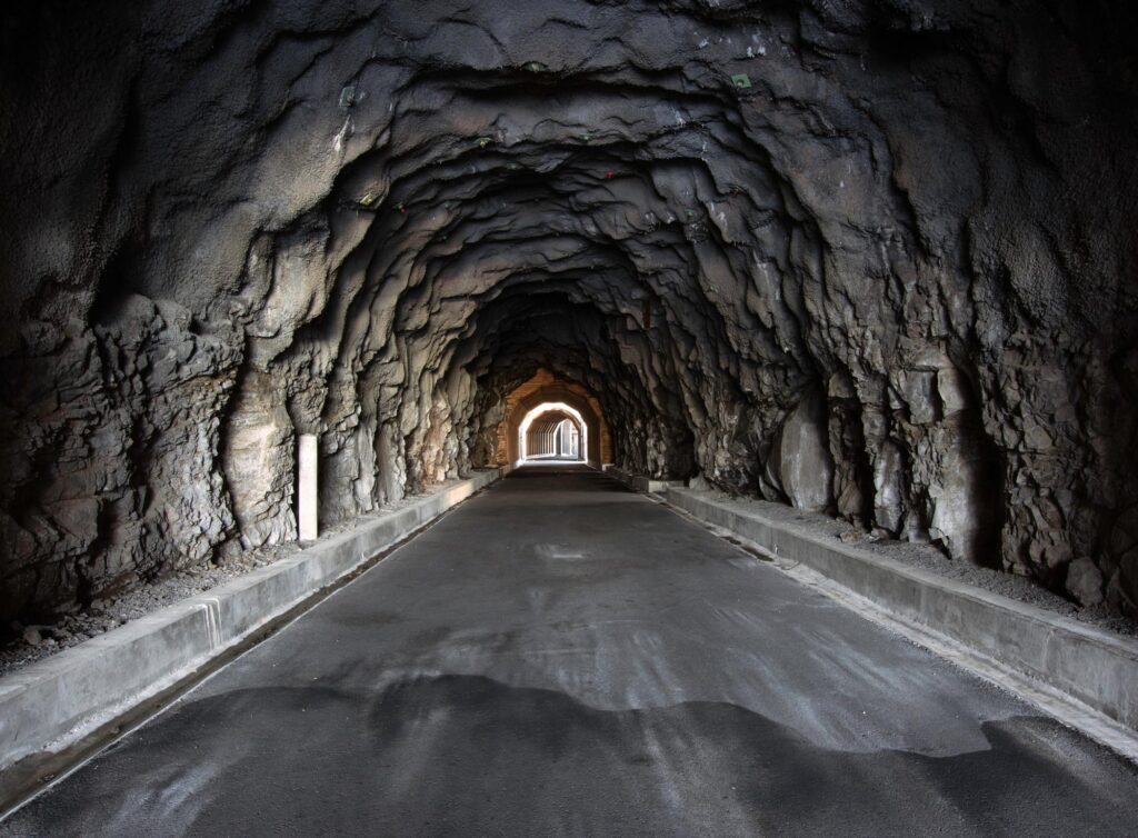
For a moment, the world outside disappears. When you emerge on the other side, the landscape shifts. The final mile becomes noticeably drier and sunnier, with ponderosa pines replacing the dense fir forest. In just a few miles, you can watch the Gorge transition from its wetter western landscape toward the semi-arid country farther east.
That’s one of the pleasures of traveling this old road on foot or by bike. The distance isn’t great, but the landscape keeps changing. A turn reveals a new view. A tunnel interrupts the light. Forest gives way to open country.
The highway still does what Lancaster intended more than a century ago. It makes you pay attention.
Insider Tips for Your Twin Tunnels Adventure
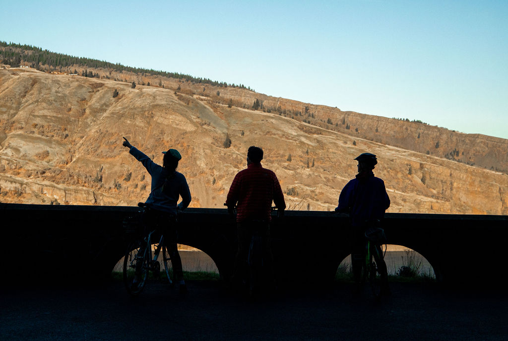
- Chase the golden hour. Ride or walk in the late afternoon for softer light and fewer crowds.
- Rent, don’t haul. Grab an e-bike, hybrid, or road bike from a local Hood River rental shop.
- Plan for parking. A $3 day-use parking permit is required at both trailheads.
- Bring a layer. The tunnels can be cool and windy, even on warm days.
- Don’t rush it. Leave room for the viewpoints, the tunnels, and the inevitable moments when you stop simply because the Gorge looks too good to pass by.
References:
ODOT: Historic Columbia River Highway
Oregon State Parks: Historic Columbia River Highway State Trail
ODOT: Historic Columbia River Highway State Trail
ODOT: Mitchell Point Tunnel Project
ODOT: Mitchell Point
National Park Service: National Historic Landmarks
National Register of Historic Places: Columbia River Highway Historic District