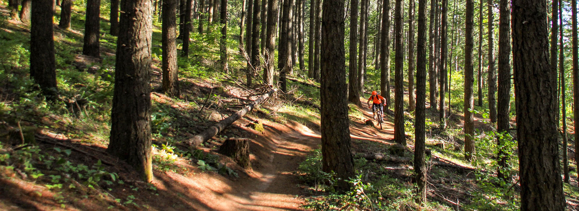
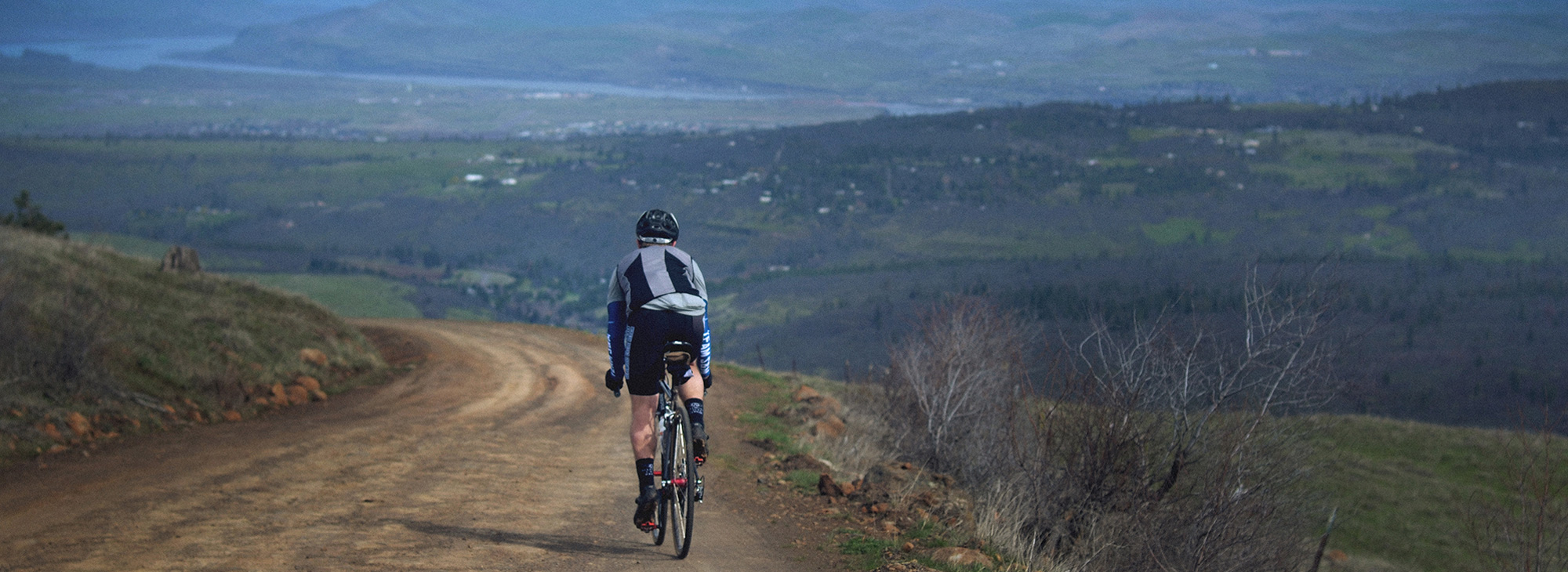
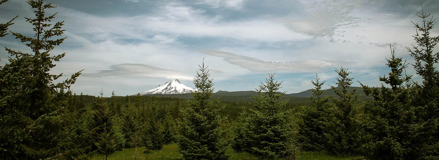
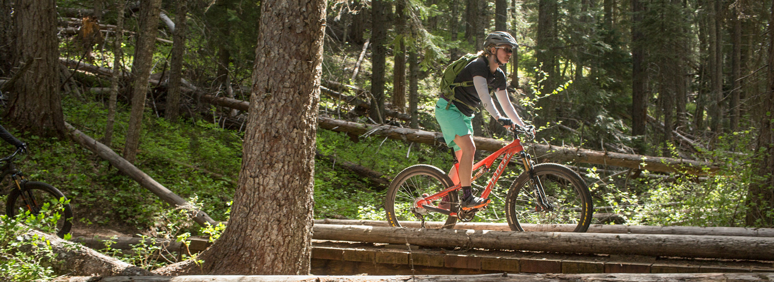
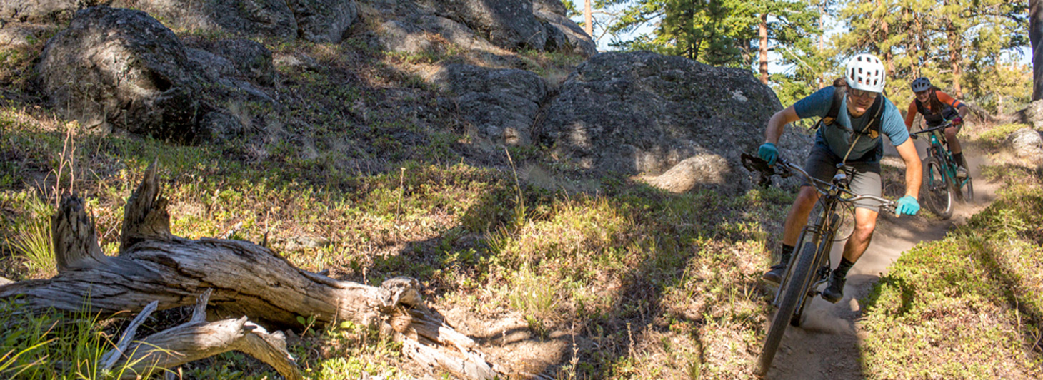
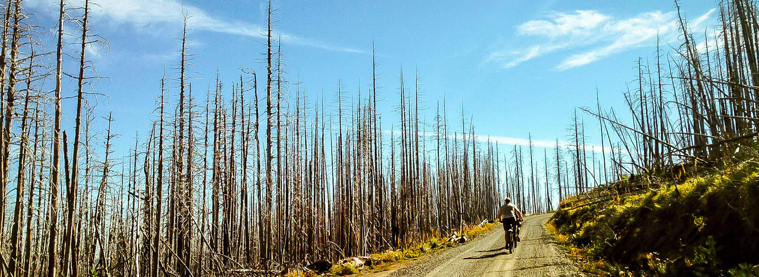
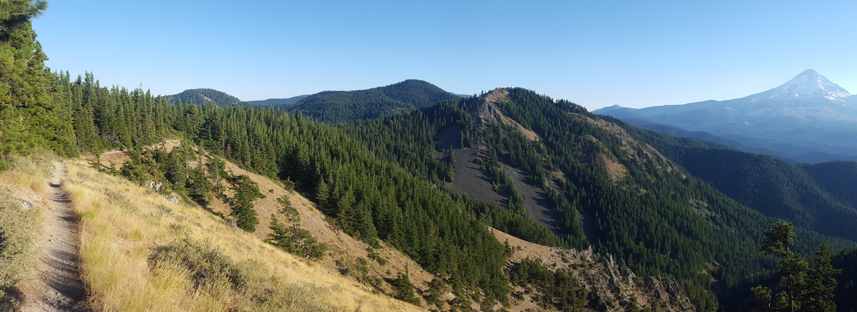
Featured

Wet Planet Rafting & Kayaking, Inc.

Wet Planet Whitewater is the Center for River Rafting and…

Hood River, OR

Indian Creek Golf Course

Indian Creek Golf Course is a hidden gem located where…

Hood River, OR

The Fruit Company (Museum & Gift Shop)

The Fruit Company, renowned for its orchard-fresh gifts sold nationwide,…

Hood River, OR
powered by Proxi
  • Category

  • Sort

Daniel Sharp
Fifteenmile Loop
This ride starts from the same point as Knebal Springs; you can consider Fifteenmile Loop the same ride, but on a different scale: a bit of climbing, a long drop… Read More

This ride starts from the same point as Knebal Springs; you can consider Fifteenmile Loop the same ride, but on a different scale: a bit of climbing, a long drop followed by an equally long climb; a downhill sprint to the finish. It’s just that Fifteenmile stretches out each of those segments – and puts you in an almost entirely different riding environment. This is one of the most remote backcountry trails in the area.

To get to the trailhead, drive south from Hood River on Highway 35 for 25 miles and turn left onto Forest Service Road 44. After 5.2 miles, veer right to stay on FS44/Dufur Valley Road and drive 3.5 miles. Turn left and park at the Eightmile Creek Trailhead. A Northwest Recreation Pass is required for parking; there is no potable water, and restrooms are available at Eightmile Campground a little farther down the road. 

From the trailhead, the Fifteenmile “lollipop” route heads south across FR44 and then descends east toward Dufur. As we indicated above, this change of direction gives the ride an entirely different feel in a totally different zone. 

But you start with a climb almost immediately, following Eightmile Creek for a few miles as it tumbles along through the trees, topping out at a rocky escarpment. All told, it’s about 700 feet over 3 miles, and it rolls up and down as you go – but mostly up.

Once you top out, you’ll want to stop briefly to get ready for the next bit. Adjust your helmet, straighten the goggles and tighten your shoes… and then drop into 7 miles of wildly fun downhill. It’ll be like the best, and longest amusement park ride ever; you’re likely to find yourself whooping – voluntarily or otherwise – on the way down. 

As you descend, you’ll pass through Fifteenmile Campground (be polite) and over the creek; here the landscape changes dramatically. Ponderosas and scraggly white oaks replace moss and Douglas firs. Unique geologic formations bubble up out of the needled forest floor, and the trail just keeps dropping away in front of you. Wallow in the pleasure. 

OK, back to reality: As much fun as the extended downhill was, the climb out is equally grueling. It’s 2,400 feet over 7 miles, give or take, and it will test even the hardiest. But make the best of it – it’s making you stronger every pedal stroke. If you’re lucky, you can stop and treat yourself to an all-you-can-eat huckleberry stop along the way.

Once you’ve worked your way out of the hole, enjoy a three-mile glide back to the trailhead; you’ve definitely earned it. 

And, just like the Knebal Springs ride, you should consider a stop in the Parkdale area, either coming or going. You can get a great meal at the Crooked Tree Tavern, part of the Cooper Spur Mountain Resort, or indulge in some high-quality coffee or tea, fresh-baked goods or a meal at the Blue Canoe Café. If you’d like to stick around overnight (and ride a trail each day?), the Old Parkdale Inn is a rambling, gracious old home surrounded by lush gardens.

Notes: If you’re looking to get a shorter ride in the same area, just park at Fifteenmile Campground and ride this as a loop instead of a lollipop; it’ll cut the distance roughly in half. And if you’re doing this ride in the summer, get an early start to beat the heat on the long climb in the last half of the ride.
Parkdale, OR
Daniel Sharp
Knebal Springs Loop
Knebal Springs may be THE classic ride in the 44Trails.org system. It seems to be one of the first trails to be clear and open in the season – these… Read More

Knebal Springs may be THE classic ride in the 44Trails.org system. It seems to be one of the first trails to be clear and open in the season – these days, as early as May. It’s a classic old-school single-track ride with something for every skill level. It may be a bit of a push for beginners; intermediate riders will get the chance to put their developing skills to use; experienced riders will love the descents and be challenged by the climb on the back side. Except for some short rocky sections and some small root/brake-bump combinations on the descent, most of the trail is pretty buff and non-technical. 

To get to the trailhead, drive south from Hood River on Highway 35 for 25 miles and turn left onto Forest Service Road 44. After 5.2 miles, veer right to stay on FS44/Dufur Valley Road and drive 3.5 miles. Turn left and park at the Eightmile Creek Trailhead. A Northwest Recreation Pass is required for parking; there is no potable water, and restrooms are available at Eightmile Campground a little farther down the road. 

And, before you ride, you may want to see what’s available at some of the amazing local farms in the Parkdale area – this charming town is right near the trailhead, and some fresh produce will be quite tasty when you get to the “meadow with a view” later in the ride. Check out Kiyokawa Family Orchards, Draper Girls Country Farm, Mt. View Orchards or Mount Hood Organic Farms.

From the trailhead, ride counterclockwise on the Knebal Loop. You’ll start off with a steep climb through the forest (the pitch ranges mostly between 4 and 10 percent, with a few sections in the teens) for two-thirds of a mile – but you can just consider this a proper warmup, and groove on your surroundings out here in nature – smell the fresh air and listen for forest creatures. And, soon enough, you get your reward with a fun three-mile descent that drops 1,200 feet. Pick your way down or fly it, based on your comfort level and trail conditions – but just try keeping a smile off your face. 

You’ll hit the low point of the trail when you cross the Middle Fork of Fivemile Creek. From here it’s roughly a four-mile climb out as you pass through the Knebal Springs Campground and up to a small meadow at the top that offers excellent views of Mount Hood. Pace yourself; it’s an extended effort with some steep grades, and there’s no shame in stopping for a breather or even walking a bit of the trail. It can also take some finesse to make it over small root obstacles, so stay alert.

Once you make it to the meadow, take a break, have a bite and enjoy the idyllic view; your (hard) work here is done. When you’re ready to access some more adrenaline, open up your suspension and enjoy the short descent back to the trailhead – a little less than a mile.

A few notes: These trails are popular, so say hello to fellow riders and offer the right-of-way to those climbing uphill. Take a second to pause and check in with riders instead of just blasting past; a little trail etiquette goes a long way to making everyone comfortable.

And a great thing about this zone is that you can easily access many rides from one parking area. If you still have the energy, head down the creek along Eightmile Trail for another six miles of single-track.
Parkdale, OR
Cloud Cap
Cloud Cap
Cloud Cap Road on Mount Hood’s northeastern flank was originally a wagon road – there’s a wooden sign to prove it – that was improved through mighty effort by Chinese… Read More

Cloud Cap Road on Mount Hood’s northeastern flank was originally a wagon road – there’s a wooden sign to prove it – that was improved through mighty effort by Chinese laborers at the end of the 19th century. At its top sits Cloud Cap Inn, built in 1889 and listed on the National Register of Historic Places. If you pedal your way up this, you’re likely to know exactly why the Inn got its name – you might even ride through clouds and pop out above them.

As you face off against the 2,531-foot elevation gain, you’ll travel through the black, standing dead-tree spires that remain from the Gnarl Ridge Burn of 2008, and as you near the top, pass into the lush verdant surroundings more familiar to Mount Hood. This moderate grade averages 4 to 6 percent over 10 miles, and the terrain trades off between maintained gravel and hard, rutted dirt with embedded rock.

As you push your way inexorably up the grade, comfort yourself with the knowledge that the original road had a stretch of 22-percent grade that not all the cars of the day could get up – the shuttle service from Hood River stopped at the bottom of that section and people had to walk up. Now here you are, cranking your way up to the Inn on the most efficient transportation machine ever devised.

At the top, you might enjoy a Mt. Hood National Forest guided tour of the Inn, which these days is used as a search-and-rescue base by a group called the Crag Rats. (Check ahead for availability and make reservations.)

If you do the Cloud Cap ride in the fall – make sure the road is still open – you might be treated to a magnificent view out over the hills and valleys of Wasco County, as the changing colors of the trees create an almost fiery landscape stretching for miles.

There are popular nearby hiking trails, plus the Cloud Cap Saddle and Tilly Jane campgrounds, so you may encounter cars, especially in the summer and fall. Because of this, as well as water bars and rocky sections, you’ll want to descend with due caution.

And once you finish, you’ve joined a long line of adventurers that stretches back more than 120 years. Take a minute to think about that.

Note: Cross or MTB tires (33c-40c) are recommended. You can find food and water at the Cooper Spur Mountain Resort.

Parkdale, OR
Chris Bernhardt, IMBA
Post Canyon
As a serious MTBer, gravity is quite possibly your best friend. And few riding experiences in Oregon take calculated advantage of gravity’s possibilities like the Post Canyon trail system outside… Read More
As a serious MTBer, gravity is quite possibly your best friend. And few riding experiences in Oregon take calculated advantage of gravity’s possibilities like the Post Canyon trail system outside Hood River.

Post Canyon is actually one of the original gravity networks in the U.S., and it has aged exceedingly well. Over time an enthusiastic group of local trail builders has populated these forested hills with a plethora of features, from perfectly bermed turns to steep roll-downs.

As a result, this destination has grown and matured into a rich network of single-track that will challenge an experienced rider with a variety of trails. The dizzying array of riding choices lets you push yourself as far as you'd like to go — drop by for a quick one-hour ride, or commit to a full-day adventure that will leave you drained but ecstatic after you drop back down to the trailhead. From the top down, there are nearly 3,400 feet of vertical descent.

Post Canyon’s lower elevation and location along the east side of the Cascades mean that it opens before many others trails in the state. It’s frequently at its best in early spring and late fall. Mid-summer can be hot and the trails get loose, so instead head up to the single-track around Mt. Hood in July and August.

Start at the Seven Streams Staging Area, where you’ll get a nice warmup along Flume Creek. Then you’ll depart the valley as you ascend toward the Family Man Staging Area. The climbing options begin to include both roads and trails, so be sure to stay in touch with your nav device as you work your way up 8 Track, Riordan Hill Road, Sexy Beast and the occasional moto track.

As you huff your way up, remember that date with gravity – the climb is a piece of work, but it’s mitigated by a nice balance of technical challenge and efficiency. Don’t pass up the scenic views on the way up – you can call it a rest or call it appreciation of nature, your call.

The ascent crests at Dirt Surfer, a relatively new trail that packs plenty of gravity-induced fun into 2 miles. Enjoy multiple drops, gnarly roots, sweet berms and some quick, punchy climbs before you emerge into a speed section that delivers plenty of air time. A short break up the road offers the chance to compare notes and adrenaline levels with your friends – but soon you’re back to business with a short, sharp drop that will regain your full attention.

OK, that happened. Now take on Borderline, a half-mile segment with a series of berms that will fully demonstrate the joys of centrifugal force. From there you’ll navigate (literally – keep an eye on your nav device) some ups and some downs that lead to a technical, fast ridgeline downhill bomb with drops, G-outs and roots.

You’ll be deeply grateful to our planet’s gravity after you track through the last few giant berms and get dumped out near your car. No doubt, you didn’t waste any of that early effort getting to the top. Now it’s time to hit the town for some cold beverages, a hearty post-workout meal and some slightly exaggerated tales of your adventures on the trails. 

Note
Post Canyon is a working forest. Trails may be closed or rerouted as trees are harvested. Fortunately, the trail stewards arrive quickly after the loggers have gone — and if you’re lucky, you may be the one to get fresh loam tracks on someone’s newest creation. For current conditions, contact the Hood River Ranger Station (541-352-6002) or one of Hood River’s several local bike shops.
Hood River, OR
Our Mother The Mountain
Mt. Hood Barlow to Bonney to Bennett
This bracing 44-mile ride carries you over alpine ridges, rocky paths, logging roads, packed gravel, river-crossings and calm, smooth pavement – and through an elevation gain of over 4,500 feet… Read More

This bracing 44-mile ride carries you over alpine ridges, rocky paths, logging roads, packed gravel, river-crossings and calm, smooth pavement – and through an elevation gain of over 4,500 feet – as you cover some of the path pioneers took to settle Oregon 150 years ago. Those hardy folks had to take on whatever lay in their path, and so will you. With this variety, you will not be bored.

From Barlow Pass, start with a bit of history as you go southeast toward Keeps Mill on the historic Barlow Road/NF-3530. The Barlow Road allowed pioneers and their wagons to avoid the treacherous and expensive float down the Columbia River on the final leg of their journey west. Enjoy the exciting four-and-a-half-mile descent, and expect loose rocks, roots, ruts and soft dirt topped with fallen needles. You’ll level onto sandy doubletrack near Barlow Creek before finding pavement after a couple miles, and then alternate between hard-packed gravel, pavement and a rough, loose rocky Jeep trail.

At about the halfway point – also the lowest point of the route – is Keeps Mill Campground, where on a hot day you might like to indulge in a cooling dip in the Clear Creek swimming hole.

How you choose to cross the White River will likely depend on the time of year: a log crossing will be the best bet when the water is swift and cold, but late in the summer season, a wade through will feel refreshing, even if it’s icy. You’ll find a reasonable crossing point in the lower portion of the campground, where the roadbed angles down.

Once you’re across, start climbing. In the spring, you’ll be greeted by beargrass and other wildflowers in the meadows. The surface fluctuates some more, from a steep and rocky ascent (at a 12 percent grade!) to smooth, gently climbing doubletrack and then back to a good old gravel-grinding climb that also includes stretches of loose rock and rutted dirt.

Take a minute to celebrate at mile 35, just past Bonney Meadows, because you’ve reached the highest point of the route. Now it’s time to break out your descending skills. Navigate some boulder-strewn scree, descending the ridge in a mix of shady forest and bright, wide-open vistas. Don’t forget to stop once in a while so you can take your eyes off the next 20 feet and drink in some spectacular views: to the north and east, trees march shoulder-to-shoulder up and down ridges and practically require you to stop and admire their postcard-perfect views. Mount Hood poses spectacularly to the west and reminds you why you take these epic rides. Keep your eye out for a brief, impressive view of Mount Jefferson to the south.

Roll down the ridge in a gradual descent to the Bennett Pass Sno-Park parking area, rolling smooth pavement back to the Barlow Pass parking area. Like a cycling pioneer, you’ve taken on a series of challenging terrain and surfaces, and overcome everything with only your strength and skills. Did the pioneers get a cold beverage at the end of a hard day? You should.

Parkdale, OR
Surveyors Ridge ride
Surveyors Ridge
Photogenic and majestic, Mt. Hood is one of the iconic spots (and images) in Oregon. In the mountain-biking world, Surveyors Ridge occupies a similar status – along with the likes… Read More

Photogenic and majestic, Mt. Hood is one of the iconic spots (and images) in Oregon. In the mountain-biking world, Surveyors Ridge occupies a similar status – along with the likes of the NUT and the McKenzie River Trail, it’s one of the routes that define single-track riding in the state. And for good reason: besides all the goodies you’d expect from an epic trail itself, it gives you some of the most fantastic views of Mt. Hood you can find – you’ll see the peak from angles most people will never experience.

The trail is like an all-you-can-eat buffet of your favorite riding: lung-busting climbs, rolling traverses through alpine meadows full of wildflowers, and a rocket descent down to the finish that will test your mettle. The highlight, though, is the unparalleled views of the back side of Mt. Hood.

You can do Surveyors Ridge as a one-way or out-and-back, but we’ve set it up as a loop for you, incorporating the Dog River Trail too. To get started, park your vehicle at the Oak Ridge trailhead just off Smullin Dr. on the east side of Highway 35 near Parkdale. You’ll begin with an easy warm-up spin, heading south on the highway toward the Dog River trailhead. Highway 35 has generally decent shoulders, and this is a regularly trafficked stretch for road bikes, too, so motorists are used to seeing riders.

Once you hit the Dog River Trail – just over 4 miles up the road, where it curves west – you get an easy break-in period... right until you hit the switchbacks. Inhale plenty of that high-mountain, forest-scented air; you won’t really have much choice, so enjoy it. But the terrain gives you a great preview of the rest of your ride: after the trail levels out a bit and the climb becomes a bit more Zen, you plunge deep into the forest, with lush ferns and scattered flowers on the forest floor and towering Douglas fir trees rising to the sky all around you.

Find your rhythm and tune in to your surroundings. The sense of splendid isolation is exhilarating, and you’ll start to feel that endorphin high. And that’s a good thing, because you’re not close to being done working. Cross a small bridge over the Dog River, and then set to work earning the descent you’re going to get later on. Between miles 6 and 10, pick up 1,600 feet, at grades that are regularly 10-percent-plus, and occasionally hit 20 percent and more. Stay strong, because about the time you think your legs are going to explode, here comes a pleasant descent through forest that’s thick with firs and pines, letting you catch back up to yourself like a mid-morning coffee. As you tackle one final upward push, be on the lookout for people riding the trail the other way – if they’re coming, they’ll be coming fast.

The end of the Dog River climb brings you to the Surveyors Ridge trail. After a short segment of Road 1720, use the Super Connector trail to reach the ridgelineSurveyors is named for, and get ready to be wowed. The trail dips, swoops and rises like the open ocean in a storm, and be sure not to miss opportunities to stop and smell the wildflowers – and get that frame-worthy shot of Mt. Hood bracketed by massive timber. At the crest of a short climb at mile 18.5, take a break to wander out to an old fire lookout; from here you can often see the volcanic lineup of Cascade Range peaks stringing north on the Washington side of the Columbia River.

OK, time to change riding modes: set your dial to DzNerves of Steel.dz Go for the gusto on a drop down and across jagged basalt; you’re going to be tested here, and so will your rims. While you’re holding on for dear life, you need to also pay attention so you don’t miss the left turn onto the Oak Ridge descent; this is actually an opportune time to take a little break to let your hands and arms rest, and your brakes to cool –because it’s just about to get even better. If you love – really love – descending, get ready for a new romance. This brief but heart-throbbing drop will either have you laughing crazily, or screaming like a little kid on a roller-coaster. Enjoy the switchbacks, which were blasted out of the hillside with dynamite. And if you’re really in the zone, see if you can make it all the way to the bottom without putting a foot down. Most can’t.

Once you survive the plunge you get a little dessert, in the form of a stretch that serpentines through the valley floor before you return to your car.

Time to take a breath, take stock... that was one stupendous ride. Do you even remember the views of Mt. Hood?

Parkdale, OR
Limberlost
Old Carroll Gilhouley
The Hood River Valley is one of the natural treasures of Oregon – both for the views over rolling terrain out to Mount Hood, and for its bounty of fruit… Read More

The Hood River Valley is one of the natural treasures of Oregon – both for the views over rolling terrain out to Mount Hood, and for its bounty of fruit and other crops. There’s even a driving route here called “The Fruit Loop.”

Get some different views on this loop from Hood River and back, a 59-mile route that gives you stunning views of Mount Hood while taking you through – and up above – bucolic orchards, red-barned farmlands, intense fire-blackened forests, and into hilltop scrub oak.

You won’t find services on this route, so be prepared. Park near the China Grove Restaurant and take the Indian Creek Trail, bypassing any Hood River traffic. You’ll have to negotiate a little traffic heading out of town, but once you’ve turned onto Wyeast Road, you won’t see vehicles for a good long while.

The route offers a varied menu of pavement, packed dirt and steep gravel climbing; you won’t get bored as you catch a whiff of pear blossoms or just inhale the clean scent of fresh air and fir trees.

When you descend from Gilhouley Road to Highway 35, you can cut out and head for town if you’ve had enough riding.

If you’re up for more fun – and more photos to prove what a blast you had – cross the highway for the gradual paved climb up Surveyor's Ridge Road. After a turn onto gravel, it’s time to test your bike-handling skills on a few miles of rough, rocky path and potholes as you pass through gates and intersections.

When it’s time to come back down form your mountain high, get ready for a rugged 12-mile ride down into the valley. Did we mention the views? From this direction you look out over a patchwork of fertile orchards and farm fields, down to the mighty Columbia River (can you spot any windsurfers from here?) and over into Washington. Guess what – you get a snow-capped mountain view both ways on this ride.

If you’ve had enough challenge and beauty for one ride, you get the choice again to opt out, at the intersection of Digger and Carroll – hop onto Carroll to avoid more gravel climbing by using the Mosier Tunnels bike path. Or continue up Old Dalles for additional farmland views before coasting back to Hood River, fully understanding why so many people come here and want to stay.

Hood River, OR
Tasting the Historic Columbia River Highway Trail
The Historic Columbia River Highway Trail is truly one of the singular routes in Oregon – and a ride almost anyone can enjoy. When you pair a stupendously beautiful route… Read More
The Historic Columbia River Highway Trail is truly one of the singular routes in Oregon – and a ride almost anyone can enjoy. When you pair a stupendously beautiful route with a relaxed, car-free environment, it’s a chance to soak in the best of Oregon with family or friends. Oh, and there’s really great food and drink available, too.

To set the scene for the ride, a little history: Completed in 1922, the Historic Columbia River Highway was America’s first scenic highway. Using engineering and construction techniques that were revolutionary at the time, a man named Sam Hill imagined and then made happen a road that allowed the day’s Model T owners to take a scenic, leisurely drive. The original design weaved its way along what is now known as “Waterfall Alley,” with its seven spectacular waterfalls in just 10 miles of road, and it also included scenic overlooks along cliff faces and even tunnels through mountainsides. When Interstate 84 was constructed, the freeway enveloped and destroyed some segments of the highway, but over time sections have been restored (largely with the help of the Friends of the HCRH). Plans are in place to connect all the segments by the road’s centennial anniversary in 2022, resulting in a continuous bike route over open roads, bike paths and some vehicle-restricted road sections, stretching from Portland to The Dalles.

This ride leads off with the crown jewel of the trail: the 4.5-mile section between the two Mark O. Hatfield Trailheads (west to east). You can start riding in downtown Hood River, beginning with a snaking ascent up to the first trailhead above town, or you can drive up to the vehicle parking lot at the official trailhead. Past here, no cars are allowed – it’s just you and the scenery and the history. Take a few moments to picture yourself in one of those early motor vehicles, tooling along on a miraculous road as you gape at the views down into the Gorge.
 
This section also includes the Mosier Twin Tunnels, where you’ll ride tucked under a massive cliff face, with “windows” between the support pillars to maintain the sense of grandeur as you pedal through the rock. Just past the tunnels is a lovely “lookout” point below and to the left – photo-worthy, for sure.

At this point the trail glides downhill steadily for a long grade to the opposite trailhead above Mosier. Here is where you should make a choice: From the west trailhead the slope has been pretty gentle to this point, but if you ride farther you’ll have to negotiate some climbing. After the trail ends, the drop down into Mosier on a back road is good twisty fun, but you’ll have to go back up whatever you go down… if you’re not sure you want to work up a sweat, consider renting an e-bike (see below) to help you get up those hills.

If you do head down into Mosier, you’ll find a bounty of some of the best wine, cider and beer tasting opportunities Oregon has to offer. And the two words everyone loves: ice cream! The oddly charming Route 30 Classics offers ice cream and vintage Porsches, under the same roof. Add in seasonal wildflowers and several swimming holes you can access with just a short walk from the highway, and this ends up being a perfect ride to represent the best of Oregon.

A wide, smooth bike path; flood-carved gorge walls bracketing a mighty river; world-class food and drink… what’s not to like?

TASTINGS
Check out this selection of local vineyards, cideries and restaurants. Be sure to plan ahead, because the hours of operation vary quite a bit.  

HIGHLIGHTS
The HCRH is packed with history, scenery, engineering magic and the option to stretch your legs.
  • Historic Columbia River Highway Trail
  • Twin Tunnels
  • Mosier Plateau Trail
  • Memaloose Overlook Trail
  • Mosier Falls

NEED A BIKE?
You can rent an e-bike to tackle a longer ride without expending so much energy, at Oregon E-Bikes in Hood River, or Route 30 Classics & Roadside Refreshments in Mosier. Oregon E-Bikes rentals include a front rack to carry belongings, plus lights, lock and a helmet. They also have the Urban Arrow, an electric cargo bike, available for families.
Hood River, OR

Up for adventure? Down for a drink? No matter your style, find your fun in Hood River.